Area Overview for BA22 7AN
Photos of BA22 7AN

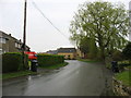
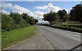
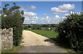
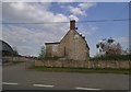


15 photos from this area
Area Information
Key information about the BA22 7AN including its size, population, and administrative classification.
- Area Type
- Postcode
- Area Size
- 2.5 hectares
- Population
- 2436
- Population Density
- 47 people/km²
House Prices in BA22 7AN
15
Properties
£356,167
Average Sold Price
£250,000
Lowest Price
£525,000
Highest Price
Showing 15 properties
| Address | Type | Beds | Baths | Last Sale Price | Last Sale Date | |
|---|---|---|---|---|---|---|
| Idless, March Lane, Galhampton, Yeovil, BA22 7AN | Detached | 4 | 1 | £405,000 | Aug 2025 | |
| Bellingham, March Lane, Galhampton, Yeovil, BA22 7AN | house | 4 | 2 | £525,000 | Sep 2023 | |
| Monymusk, March Lane, Galhampton, Yeovil, BA22 7AN | Bungalow | - | - | £425,000 | May 2022 | |
| Greenbanks, March Lane, Galhampton, Yeovil, BA22 7AN | Bungalow | - | - | £250,000 | May 2017 | |
| Weavers, March Lane, Galhampton, Yeovil, BA22 7AN | Detached | 4 | - | £340,000 | May 2017 | |
| Rowans, March Lane, Galhampton, Yeovil, BA22 7AN | Detached | 4 | 2 | £315,000 | Jul 2014 | |
| Applejack, March Lane, Galhampton, Yeovil, BA22 7AN | house | - | - | £307,500 | Dec 2013 | |
| Southfields, March Lane, Galhampton, Yeovil, BA22 7AN | house | - | - | £285,000 | Jun 2010 | |
| Marchfields, March Lane, Galhampton, Yeovil, BA22 7AN | house | - | - | £353,000 | Jul 2004 | |
| Gunhill, March Lane, Galhampton, Yeovil, BA22 7AN | Detached | 3 | 2 | - | - |
Page 1 of 2
Energy Efficiency in BA22 7AN
Amenities
Schools
| Rank | School | Type | Entry gender | Ages |
|---|
Explore more schools in this area
Go to Schools tabDemographics
Household Size
Two person
most common
Accommodation Type
Houses
most common
Tenure
79
majority
Ethnic Group
White
most common
Religion
N/A
most common
Household Composition
N/A
most common
Age
47
median
Adults (30-64 years)
most common
Household Deprivation
N/A
with no deprivation
NS-SEC
41
in Lower managerial occupations
Explore more demographic insights in this area
Go to Demographics tabPlanning
Planning Constraints
- Flood RiskPremium
- Ramsar Wetland SitesPremium
- Area of Outstanding Natural BeautyPremium
- Protected Nature ReservePremium
- Protected WoodlandPremium