Area Overview for BA21 5JA
Photos of BA21 5JA
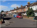
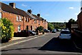
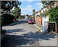
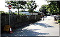
53 photos from this area
Area Information
Key information about the BA21 5JA including its size, population, and administrative classification.
- Area Type
- Postcode
- Area Size
- 7428 m²
- Population
- 1479
- Population Density
- 1799 people/km²
House Prices in BA21 5JA
19
Properties
£154,958
Average Sold Price
£108,000
Lowest Price
£210,000
Highest Price
Showing 19 properties
| Address | Type | Beds | Baths | Last Sale Price | Last Sale Date | |
|---|---|---|---|---|---|---|
| 130 Lyde Road, Yeovil, BA21 5JA | Terraced | 3 | 1 | £202,500 | Sep 2025 | |
| 104 Lyde Road, Yeovil, BA21 5JA | Terraced | 3 | 1 | £210,000 | Sep 2024 | |
| 120 Lyde Road, Yeovil, BA21 5JA | Terraced | 3 | 1 | £193,000 | Jan 2023 | |
| 128 Lyde Road, Yeovil, BA21 5JA | Terraced | 3 | 1 | £185,000 | Oct 2021 | |
| 98 Lyde Road, Yeovil, BA21 5JA | Terraced | 3 | 1 | £137,500 | Sep 2020 | |
| 114 Lyde Road, Yeovil, BA21 5JA | Terraced | 3 | - | £157,000 | Nov 2019 | |
| 100 Lyde Road, Yeovil, BA21 5JA | Terraced | 5 | 2 | £132,000 | Mar 2019 | |
| 108 Lyde Road, Yeovil, BA21 5JA | Terraced | 3 | 2 | £165,000 | Oct 2017 | |
| 96 Lyde Road, Yeovil, BA21 5JA | Terraced | 4 | 2 | £125,000 | Sep 2013 | |
| 124 Lyde Road, Yeovil, BA21 5JA | Terraced | - | - | £125,000 | Oct 2008 |
Page 1 of 2
Energy Efficiency in BA21 5JA
Amenities
Schools
| Rank | School | Type | Entry gender | Ages |
|---|
Explore more schools in this area
Go to Schools tabDemographics
Household Size
Family (3-5 people)
most common
Accommodation Type
Houses
most common
Tenure
53
majority
Ethnic Group
White
most common
Religion
N/A
most common
Household Composition
N/A
most common
Age
47
median
Adults (30-64 years)
most common
Household Deprivation
N/A
with no deprivation
NS-SEC
22
in Lower managerial occupations
Explore more demographic insights in this area
Go to Demographics tabPlanning
Planning Constraints
- Flood RiskPremium
- Ramsar Wetland SitesPremium
- Area of Outstanding Natural BeautyPremium
- Protected Nature ReservePremium
- Protected WoodlandPremium