Area Overview for BA21 4EB
Photos of BA21 4EB
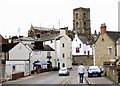
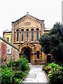
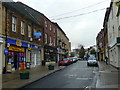
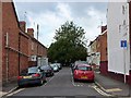
100 photos from this area
Area Information
Key information about the BA21 4EB including its size, population, and administrative classification.
- Area Type
- Postcode
- Area Size
- 2613 m²
- Population
- 1582
- Population Density
- 8567 people/km²
House Prices in BA21 4EB
19
Properties
£157,705
Average Sold Price
£43,950
Lowest Price
£296,000
Highest Price
Showing 19 properties
| Address | Type | Beds | Baths | Last Sale Price | Last Sale Date | |
|---|---|---|---|---|---|---|
| 49 Crofton Park, Yeovil, BA21 4EB | Semi-detached | 3 | 1 | £296,000 | Sep 2023 | |
| 41 Crofton Park, Yeovil, BA21 4EB | Retail | 3 | 1 | £172,000 | Oct 2022 | |
| 35 Crofton Park, Yeovil, BA21 4EB | house | 1 | 1 | £210,000 | Aug 2022 | |
| 33 Crofton Park, Yeovil, BA21 4EB | house | 3 | - | £175,000 | Aug 2020 | |
| 31 Crofton Park, Yeovil, BA21 4EB | Terraced | 3 | 1 | £168,000 | Dec 2017 | |
| 29 Crofton Park, Yeovil, BA21 4EB | Terraced | 3 | 1 | £146,000 | Mar 2016 | |
| 39 Crofton Park, Yeovil, BA21 4EB | Terraced | 3 | - | £120,100 | Apr 2014 | |
| 43 Crofton Park, Yeovil, BA21 4EB | house | 3 | - | £145,000 | Sep 2009 | |
| 45 Crofton Park, Yeovil, BA21 4EB | house | - | - | £101,000 | Nov 2002 | |
| 27 Crofton Park, Yeovil, BA21 4EB | Terraced | - | - | £43,950 | Dec 1996 |
Page 1 of 2
Energy Efficiency in BA21 4EB
Amenities
Schools
| Rank | School | Type | Entry gender | Ages |
|---|
Explore more schools in this area
Go to Schools tabDemographics
Household Size
Two person
most common
Accommodation Type
Houses
most common
Tenure
50
majority
Ethnic Group
White
most common
Religion
N/A
most common
Household Composition
N/A
most common
Age
47
median
Adults (30-64 years)
most common
Household Deprivation
N/A
with no deprivation
NS-SEC
28
in Lower managerial occupations
Explore more demographic insights in this area
Go to Demographics tabPlanning
Planning Constraints
- Flood RiskPremium
- Ramsar Wetland SitesPremium
- Area of Outstanding Natural BeautyPremium
- Protected Nature ReservePremium
- Protected WoodlandPremium