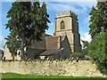
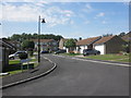
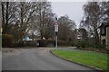
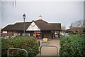
Area Overview for BA20 2HB
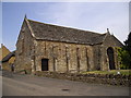
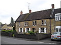
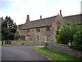
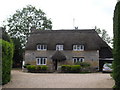
Photos of BA20 2HB
Area Information
Living in BA20 2HB means being part of a compact, densely populated residential cluster in Somerset. The area covers 1.9 hectares and is home to 2,231 residents, translating to a population density of 1,951 people per square kilometre. This small postcode area is nestled in Yeovil, a historic market town near the Dorset border, approximately 203 kilometres west of London. Daily life here is shaped by its tight-knit community feel, with proximity to essential amenities and transport links. The area’s historical roots as an ancient parish and former market town add a layer of continuity, though modern infrastructure ensures practicality. Residents benefit from a mix of retail, rail, and air connectivity, while the low flood risk and absence of protected natural areas suggest a relatively straightforward planning environment. For those seeking a balance between historical charm and contemporary convenience, BA20 2HB offers a focused, manageable footprint with clear access to services and transport hubs.
- Area Type
- Postcode
- Area Size
- 1.9 hectares
- Population
- 2231
- Population Density
- 1951 people/km²
The property market in BA20 2HB is largely owner-occupied, with 74% of homes owned by residents rather than rented. This reflects a community prioritising long-term investment in housing. The predominant accommodation type is houses, indicating a focus on family-friendly or semi-detached properties. Given the area’s small size (1.9 hectares) and high population density, the housing stock is likely limited, with buyers potentially needing to look beyond the immediate postcode for additional options. The absence of flats or apartments suggests a more traditional, low-rise residential character. For buyers, this means a market skewed towards established homes rather than new developments, with potential for stable property values. However, the compact nature of the area may limit scope for expansion or redevelopment, requiring careful consideration of nearby zones for broader opportunities.
House Prices in BA20 2HB
Showing 1 properties
| Address | Type | Beds | Baths | Last Sale Price | Last Sale Date | |
|---|---|---|---|---|---|---|
| Preston Park Elderly Persons Home, Preston Road, Yeovil, BA20 2HB | commercial | - | - | - | - |
Energy Efficiency in BA20 2HB
Residents of BA20 2HB have access to a range of amenities within practical reach. The retail sector includes major chains such as Asda Yeovil, Tesco Yeovil, and Morrisons North, providing everyday shopping convenience. The area’s rail network connects to Yeovil Pen Mill, Yeovil Junction, and Thornford stations, facilitating travel to nearby towns. The presence of RNAS Yeovilton airport adds regional connectivity, though its military focus may limit civilian use. While the data does not mention parks or leisure facilities, the high population density suggests a compact living environment where amenities are closely clustered. The combination of retail, rail, and air access supports a practical lifestyle, though the absence of specific leisure or green space details means residents may need to travel further for recreational activities.
Amenities
Schools
The nearest schools to BA20 2HB include Quantock Education Trust and Focus School – Yeovil Primary Campus, both of which are independent institutions. These schools cater to families seeking private education, though no Ofsted ratings are provided in the data. The presence of two independent schools suggests a local demand for non-state education, potentially aligning with the area’s demographic profile of mature, home-owning residents. However, the absence of state schools or information on their quality means families may need to consider commuting to nearby towns for public education options. The mix of school types indicates a choice between private and public systems, but the specific needs of students—such as academic focus or extracurricular offerings—remain unaddressed by the available data.
| Rank | School | Type | Entry gender | Ages |
|---|
Explore more schools in this area
Go to Schools tabDemographics
The population of BA20 2HB is predominantly adults aged 30–64, with a median age of 47. This suggests a mature, stable community with a strong presence of families and professionals. Home ownership is high at 74%, reflecting a preference for long-term residency over rental properties. The area is characterised by houses rather than flats, aligning with a suburban or semi-rural housing stock. The predominant ethnic group is White, with no specific data provided on other demographics. The high population density of 1,951 people per square kilometre indicates a compact living environment, which may influence the availability of private space. While no explicit deprivation data is included, the demographic profile suggests a community with established economic stability, though the absence of younger age groups might affect local amenities tailored to children or students.
Household Size
Accommodation Type
Tenure
Ethnic Group
Religion
Household Composition
Age
Household Deprivation
NS-SEC
Explore more demographic insights in this area
Go to Demographics tabPlanning
Planning Constraints
- Flood RiskPremium
- Ramsar Wetland SitesPremium
- Area of Outstanding Natural BeautyPremium
- Protected Nature ReservePremium
- Protected WoodlandPremium