Area Overview for BA20 2FW
Photos of BA20 2FW
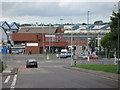
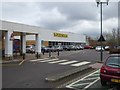


26 photos from this area
Area Information
Key information about the BA20 2FW including its size, population, and administrative classification.
- Area Type
- Postcode
- Area Size
- 2.4 hectares
- Population
- Not available
- Population Density
- Not available
House Prices in BA20 2FW
87
Properties
£85,125
Average Sold Price
£35,000
Lowest Price
£110,000
Highest Price
Showing 87 properties
| Address | Type | Beds | Baths | Last Sale Price | Last Sale Date | |
|---|---|---|---|---|---|---|
| 70 Fosse Park Road, Yeovil, BA20 2FW | house | 2 | 1 | £92,500 | Jul 2023 | |
| 78 Fosse Park Road, Yeovil, BA20 2FW | house | - | - | £88,000 | Dec 2017 | |
| 74 Fosse Park Road, Yeovil, BA20 2FW | house | - | - | £101,250 | Dec 2017 | |
| 60 Fosse Park Road, Yeovil, BA20 2FW | house | - | - | £84,000 | Nov 2017 | |
| 76 Fosse Park Road, Yeovil, BA20 2FW | house | - | - | £110,000 | Nov 2017 | |
| 59 Fosse Park Road, Yeovil, BA20 2FW | Terraced | 2 | 1 | £35,000 | Dec 2009 | |
| 1 Fosse Park Road, Yeovil, BA20 2FW | Terraced | 3 | 2 | - | - | |
| 39 Fosse Park Road, Yeovil, BA20 2FW | Flat | 3 | 2 | - | - | |
| 43 Fosse Park Road, Yeovil, BA20 2FW | Flat | 3 | 2 | - | - | |
| 33 Fosse Park Road, Yeovil, BA20 2FW | Terraced | 2 | 1 | - | - |
Page 1 of 9
Energy Efficiency in BA20 2FW
Amenities
Schools
| Rank | School | Type | Entry gender | Ages |
|---|
Explore more schools in this area
Go to Schools tabDemographics
Household Size
Family (3-5 people)
most common
Accommodation Type
Houses
most common
Tenure
57
majority
Ethnic Group
White
most common
Religion
N/A
most common
Household Composition
N/A
most common
Age
47
median
Adults (30-64 years)
most common
Household Deprivation
N/A
with no deprivation
NS-SEC
26
in Lower managerial occupations
Explore more demographic insights in this area
Go to Demographics tabPlanning
Planning Constraints
- Flood RiskPremium
- Ramsar Wetland SitesPremium
- Area of Outstanding Natural BeautyPremium
- Protected Nature ReservePremium
- Protected WoodlandPremium