Area Overview for BA20 1TY
Photos of BA20 1TY


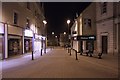
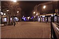

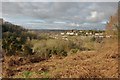
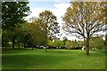


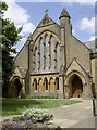
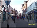
100 photos from this area
Area Information
Key information about the BA20 1TY including its size, population, and administrative classification.
- Area Type
- Postcode
- Area Size
- 5905 m²
- Population
- Not available
- Population Density
- Not available
House Prices in BA20 1TY
38
Properties
£66,250
Average Sold Price
£25,000
Lowest Price
£83,000
Highest Price
Showing 38 properties
| Address | Type | Beds | Baths | Last Sale Price | Last Sale Date | |
|---|---|---|---|---|---|---|
| 64, Wellington Flats, Wellington Street, Yeovil, BA20 1TY | Flat | - | - | £83,000 | Mar 2019 | |
| 44, Wellington Flats, Wellington Street, Yeovil, BA20 1TY | Flat | 1 | - | £81,000 | Oct 2007 | |
| 48, Wellington Flats, Wellington Street, Yeovil, BA20 1TY | Flat | - | - | £76,000 | Sep 2004 | |
| 68, Wellington Flats, Wellington Street, Yeovil, BA20 1TY | Flat | - | - | £25,000 | Dec 1997 | |
| 71, Wellington Flats, Wellington Street, Yeovil, BA20 1TY | Flat | 2 | - | - | - | |
| 61, Wellington Flats, Wellington Street, Yeovil, BA20 1TY | Flat | 1 | - | - | - | |
| 55, Wellington Flats, Wellington Street, Yeovil, BA20 1TY | Flat | - | - | - | - | |
| 49, Wellington Flats, Wellington Street, Yeovil, BA20 1TY | Maisonette | - | - | - | - | |
| 41, Wellington Flats, Wellington Street, Yeovil, BA20 1TY | Flat | - | - | - | - | |
| 38, Wellington Flats, Wellington Street, Yeovil, BA20 1TY | Flat | - | - | - | - |
Page 1 of 4
Energy Efficiency in BA20 1TY
Amenities
Schools
| Rank | School | Type | Entry gender | Ages |
|---|
Explore more schools in this area
Go to Schools tabDemographics
Household Size
One person
most common
Accommodation Type
Flats
most common
Tenure
37
majority
Ethnic Group
White
most common
Religion
N/A
most common
Household Composition
N/A
most common
Age
47
median
Adults (30-64 years)
most common
Household Deprivation
N/A
with no deprivation
NS-SEC
26
in Lower managerial occupations
Explore more demographic insights in this area
Go to Demographics tabPlanning
Planning Constraints
- Flood RiskPremium
- Ramsar Wetland SitesPremium
- Area of Outstanding Natural BeautyPremium
- Protected Nature ReservePremium
- Protected WoodlandPremium