Area Overview for BA2 9YH
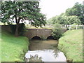
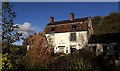
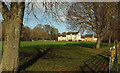
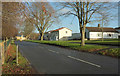
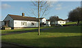
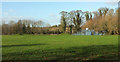
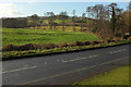
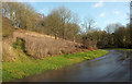
Photos of BA2 9YH
Area Information
BA2 9YH is a small residential cluster in the western suburbs of Bath, England, with a population of 1602. Historically a Saxon settlement known as Twiverton, it became part of Bath in 1911 after centuries of agricultural and industrial activity. Today, it is a working-class urban area with a strong community spirit, though it ranks among England’s top 20% most deprived areas. The postcode covers a compact area with a mix of post-war council housing and older homes, reflecting its role as a suburban extension of Bath. Daily life here is shaped by proximity to Bath’s cultural and commercial hubs, with nearby rail links to Bath Spa and Bristol. The area’s character is defined by its modest scale, local amenities, and historical roots, including remnants of medieval manors and 19th-century industrial sites. Residents benefit from proximity to Twerton Park, a sports venue, and the Bath City Farm, offering green space and community activities. While the area’s affordability and transport links make it appealing, its social challenges and crime rates require careful consideration for prospective buyers.
- Area Type
- Postcode
- Area Size
- Not available
- Population
- 1602
- Population Density
- 2853 people/km²
The property market in BA2 9YH is characterised by a 36% home ownership rate, with houses being the predominant accommodation type. This suggests a mix of owner-occupied properties and rental stock, though the small area’s limited housing stock may mean buyers must consider nearby suburbs or Bath itself for larger options. The presence of post-war council housing indicates a focus on modest, family-friendly homes rather than high-end properties. For buyers, this means a market skewed toward affordability over luxury, with potential for long-term value retention in a stable, low-risk area. However, the limited housing supply and proximity to Bath’s more competitive market may influence price trends. Those seeking owner-occupied homes should prioritise condition and location within the cluster, as the area’s compact size means proximity to amenities and transport is critical.
House Prices in BA2 9YH
No properties found in this postcode.
Energy Efficiency in BA2 9YH
Residents of BA2 9YH have access to a range of local amenities, including five retail outlets such as Morrisons, Co-op, and M&S, providing everyday shopping convenience. The area’s rail network, with five stations, ensures easy access to Bath and Bristol, while two metro stops offer additional transport options. Nearby Twerton Park hosts sports events and community activities, and the Bath City Farm offers recreational space for families. The historical Twerton High Street, part of the Bath-Bristol road, retains a local character. While the area lacks high-end dining or entertainment, its proximity to Bath means residents can access cultural and commercial hubs. The mix of retail, transport, and green spaces supports a practical lifestyle, though those prioritising luxury amenities may find the area’s offerings modest compared to Bath’s city centre.
Amenities
Schools
Residents of BA2 9YH have access to two primary schools: St Michael’s CofE Junior School, a state-funded institution, and St Michaels Junior Church School, an academy with a Good Ofsted rating. The coexistence of a state school and an academy provides families with options that balance affordability and educational standards. Both institutions serve the local community, with St Michaels’ academy status potentially offering additional resources or specialisms. The Good rating at St Michaels suggests a reliable educational environment, though parents may need to consider travel times for older children, given the area’s limited secondary school options. The presence of two schools within practical reach supports families seeking proximity to education while maintaining a choice between different school models.
| Rank | School | Type | Entry gender | Ages |
|---|
Explore more schools in this area
Go to Schools tabDemographics
The median age in BA2 9YH is 47, with the majority of residents aged 30–64. Home ownership stands at 36%, indicating a significant proportion of households rent from the council or social housing providers. The area is predominantly White, though specific diversity statistics are not provided. As one of England’s most deprived areas, residents may face challenges such as limited access to high-quality services or employment opportunities. The working-age population dominates, suggesting a community focused on established careers and family life. With 48% of households in rental accommodation, the area reflects a mix of long-term residents and those seeking affordable housing. The demographic profile aligns with Twerton’s history as a post-war housing development, where council estates and older homes coexist. This balance of tenure types and age groups creates a stable but economically modest community.
Household Size
Accommodation Type
Tenure
Ethnic Group
Religion
Household Composition
Age
Household Deprivation
NS-SEC
Explore more demographic insights in this area
Go to Demographics tabPlanning
Planning Constraints
- Flood RiskPremium
- Ramsar Wetland SitesPremium
- Area of Outstanding Natural BeautyPremium
- Protected Nature ReservePremium
- Protected WoodlandPremium