Area Overview for BA2 9YB
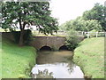
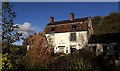
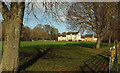
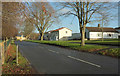
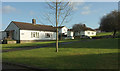
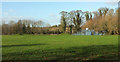
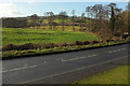
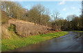
Photos of BA2 9YB
Area Information
Living in BA2 9YB means being part of a small, tightly knit residential cluster in the west of Bath, a historic city in Somerset. With a population of 1,602, this area retains echoes of its Saxon origins, once known as Twiverton, and its integration into Bath in 1911. Daily life here is shaped by its working-class character, with 48% of households renting from councils or social housing providers. The area’s proximity to Bath’s cultural and historical landmarks, combined with its practical connectivity to rail networks and local amenities, offers a blend of heritage and modern convenience. Twerton’s identity is rooted in its industrial past, from 18th-century wool mills to the Bath City Farm, which now provides green space for residents. The community, though modest in means, is described as having a strong sense of local spirit. For buyers, BA2 9YB represents a compact, affordable option with access to essential services, though its small size means proximity to Bath’s central amenities is key.
- Area Type
- Postcode
- Area Size
- Not available
- Population
- 1602
- Population Density
- 2853 people/km²
The property market in BA2 9YB is characterised by a low home ownership rate of 36%, with houses being the predominant accommodation type. This suggests a rental-focused market, where a significant proportion of residents live in council or social housing. The limited number of owner-occupied homes may reflect the area’s history of post-war housing developments and its status as a deprived region. For buyers, this small area offers a niche opportunity, but the housing stock is likely to be constrained by its size and the dominance of rental properties. Prospective buyers should consider the proximity to Bath’s broader property market, where more diverse options exist. The mix of older, modest homes and newer developments may appeal to those seeking affordability over luxury.
House Prices in BA2 9YB
No properties found in this postcode.
Energy Efficiency in BA2 9YB
Life in BA2 9YB is shaped by its proximity to retail, leisure, and green spaces. Within reach are five retail outlets, including Morrisons Daily Twerton 105, Co-op Mount, and M&S Weston, offering everyday shopping needs. The area’s rail and metro links provide access to Bath’s cultural and commercial hubs. Locally, Twerton Park stadium hosts Bath City FC, and the Bath City Farm offers recreational space. Twerton Roundhill, a hilltop with panoramic views, provides a contrast to the area’s urban character. The historical Twerton High Street, part of the Bath-Bristol road, adds to the sense of place. While the amenities are practical, the area’s charm lies in its blend of modest convenience and historical remnants, offering a grounded lifestyle for residents.
Amenities
Schools
Residents of BA2 9YB have access to two primary schools: St Michael’s CofE Junior School and St Michaels Junior Church School. The latter is an academy with a Good Ofsted rating, indicating a strong educational standard. The presence of both a traditional church school and an academy provides families with choices in schooling, though both cater to younger children. The absence of secondary schools in the immediate area means that families may need to look further afield to Bath or surrounding towns for secondary education. This mix of school types reflects the area’s blend of historical and contemporary educational provision, though the limited range of schools may be a consideration for those prioritising a full spectrum of educational options.
| Rank | School | Type | Entry gender | Ages |
|---|
Explore more schools in this area
Go to Schools tabDemographics
The population of BA2 9YB has a median age of 47, with the majority of residents falling within the 30-64 age range. Home ownership stands at 36%, reflecting a housing market where rental properties, particularly council or social housing, dominate. The area’s predominant ethnic group is White, and its working-class character is evident in its demographics. BA2 9YB ranks among England’s top 20% most deprived areas, which can impact access to services and opportunities. This deprivation score indicates that residents may face challenges in areas such as employment, education, or healthcare, though local amenities and community networks offer some resilience. The age profile suggests a stable, middle-aged population, which may influence the types of housing and services in demand.
Household Size
Accommodation Type
Tenure
Ethnic Group
Religion
Household Composition
Age
Household Deprivation
NS-SEC
Explore more demographic insights in this area
Go to Demographics tabPlanning
Planning Constraints
- Flood RiskPremium
- Ramsar Wetland SitesPremium
- Area of Outstanding Natural BeautyPremium
- Protected Nature ReservePremium
- Protected WoodlandPremium