Area Overview for BA2 9BB
Photos of BA2 9BB
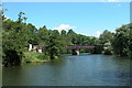
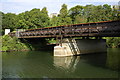
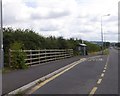
![Kelston Park Railway Bridge [No 209], from the west in BA2 9BB](https://images.propbar.co.uk/images/geograph/44/83/4483820_120.jpg)
66 photos from this area
Area Information
Key information about the BA2 9BB including its size, population, and administrative classification.
- Area Type
- Postcode
- Area Size
- 7.1 hectares
- Population
- 2326
- Population Density
- 118 people/km²
House Prices in BA2 9BB
2
Properties
-
Average Sold Price
-
Lowest Price
-
Highest Price
Showing 2 properties
| Address | Type | Beds | Baths | Last Sale Price | Last Sale Date | |
|---|---|---|---|---|---|---|
| Flat 5, The Old Telephone Exchange, Pennyquick, Newton St Loe, Bath, BA2 9BB | Flat | - | - | - | - | |
| The Flat, The Globe Inn, Pennyquick, Newton St Loe, Bath, BA2 9BB | Flat | - | - | - | - |
Energy Efficiency in BA2 9BB
Amenities
Schools
| Rank | School | Type | Entry gender | Ages |
|---|
Explore more schools in this area
Go to Schools tabDemographics
Household Size
Two person
most common
Accommodation Type
Houses
most common
Tenure
67
majority
Ethnic Group
White
most common
Religion
N/A
most common
Household Composition
N/A
most common
Age
22
median
Young Adults (15-29 years)
most common
Household Deprivation
N/A
with no deprivation
NS-SEC
17
in Lower managerial occupations
Explore more demographic insights in this area
Go to Demographics tabPlanning
Planning Constraints
- Flood RiskPremium
- Ramsar Wetland SitesPremium
- Area of Outstanding Natural BeautyPremium
- Protected Nature ReservePremium
- Protected WoodlandPremium