Area Overview for BA2 8LL
Photos of BA2 8LL
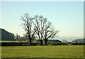
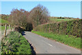
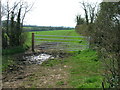
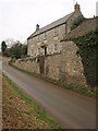
13 photos from this area
Area Information
Key information about the BA2 8LL including its size, population, and administrative classification.
- Area Type
- Postcode
- Area Size
- 41.4 hectares
- Population
- 1672
- Population Density
- 903 people/km²
House Prices in BA2 8LL
12
Properties
£4,306,667
Average Sold Price
£250,000
Lowest Price
£12,290,000
Highest Price
Showing 12 properties
| Address | Type | Beds | Baths | Last Sale Price | Last Sale Date | |
|---|---|---|---|---|---|---|
| Braysdown Farm House, Colliery Lane, Peasedown St John, Bath, BA2 8LL | Detached | - | - | £12,290,000 | Mar 2018 | |
| 6, Braysdown Yard, Colliery Lane, Peasedown St John, Bath, BA2 8LL | house | 5 | - | £380,000 | Aug 2014 | |
| 2, Braysdown House, Colliery Lane, Peasedown St John, Bath, BA2 8LL | Semi-detached | - | - | £250,000 | Apr 2006 | |
| 5, Braysdown Yard, Colliery Lane, Peasedown St John, Bath, BA2 8LL | Terraced | 3 | - | - | - | |
| White Lias, Colliery Lane, Peasedown St John, Bath, BA2 8LL | Detached | 3 | 2 | - | - | |
| 4, Braysdown Yard, Colliery Lane, Peasedown St John, Bath, BA2 8LL | Terraced | - | - | - | - | |
| Braysdown Works, Colliery Lane, Peasedown St John, Bath, BA2 8LL | Industrial | - | - | - | - | |
| Unit C, Colliery Lane, Peasedown St John, Bath, BA2 8LL | Industrial | - | - | - | - | |
| Braysdown Cottage, Colliery Lane, Peasedown St John, Bath, BA2 8LL | Detached | - | - | - | - | |
| Unit E, Colliery Lane, Peasedown St John, Bath, BA2 8LL | Industrial | - | - | - | - |
Page 1 of 2
Energy Efficiency in BA2 8LL
Amenities
Schools
| Rank | School | Type | Entry gender | Ages |
|---|
Explore more schools in this area
Go to Schools tabDemographics
Household Size
Family (3-5 people)
most common
Accommodation Type
Houses
most common
Tenure
83
majority
Ethnic Group
White
most common
Religion
N/A
most common
Household Composition
N/A
most common
Age
47
median
Adults (30-64 years)
most common
Household Deprivation
N/A
with no deprivation
NS-SEC
39
in Lower managerial occupations
Explore more demographic insights in this area
Go to Demographics tabPlanning
Planning Constraints
- Flood RiskPremium
- Ramsar Wetland SitesPremium
- Area of Outstanding Natural BeautyPremium
- Protected Nature ReservePremium
- Protected WoodlandPremium