Area Overview for BA2 8DY
Photos of BA2 8DY
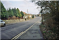
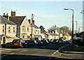
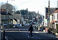
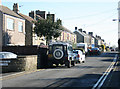
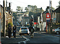
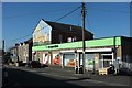
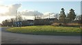
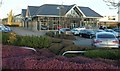
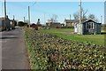
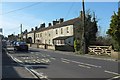
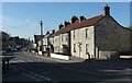
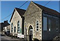
33 photos from this area
Area Information
Key information about the BA2 8DY including its size, population, and administrative classification.
- Area Type
- Postcode
- Area Size
- 7817 m²
- Population
- 1621
- Population Density
- 938 people/km²
House Prices in BA2 8DY
9
Properties
£273,000
Average Sold Price
£68,000
Lowest Price
£370,000
Highest Price
Showing 9 properties
| Address | Type | Beds | Baths | Last Sale Price | Last Sale Date | |
|---|---|---|---|---|---|---|
| Fairview, Huddox Hill, Peasedown St John, Bath, BA2 8DY | Detached | 4 | 2 | £370,000 | Mar 2023 | |
| Sunnyview, Huddox Hill, Peasedown St John, Bath, BA2 8DY | Detached | 5 | 2 | £365,000 | Sep 2022 | |
| Westbury View, Huddox Hill, Peasedown St John, Bath, BA2 8DY | Detached | 3 | 1 | £250,000 | Jul 2007 | |
| Deep End, Huddox Hill, Peasedown St John, Bath, BA2 8DY | Detached | - | - | £300,000 | Jun 2004 | |
| Colashdon, Huddox Hill, Peasedown St John, Bath, BA2 8DY | Detached | 4 | 2 | £285,000 | Dec 2003 | |
| Pleasant View, Huddox Hill, Peasedown St John, Bath, BA2 8DY | Detached | - | - | £68,000 | Feb 1996 | |
| Corniche, Huddox Hill, Peasedown St John, Bath, BA2 8DY | Detached | - | - | - | - | |
| Beau Geste, Huddox Hill, Peasedown St John, Bath, BA2 8DY | Detached | - | - | - | - | |
| Orchard Lea, Huddox Hill, Peasedown St John, Bath, BA2 8DY | Detached | - | - | - | - |
Energy Efficiency in BA2 8DY
Amenities
Schools
| Rank | School | Type | Entry gender | Ages |
|---|
Explore more schools in this area
Go to Schools tabDemographics
Household Size
Two person
most common
Accommodation Type
Houses
most common
Tenure
86
majority
Ethnic Group
White
most common
Religion
N/A
most common
Household Composition
N/A
most common
Age
47
median
Adults (30-64 years)
most common
Household Deprivation
N/A
with no deprivation
NS-SEC
37
in Lower managerial occupations
Explore more demographic insights in this area
Go to Demographics tabPlanning
Planning Constraints
- Flood RiskPremium
- Ramsar Wetland SitesPremium
- Area of Outstanding Natural BeautyPremium
- Protected Nature ReservePremium
- Protected WoodlandPremium