Area Overview for BA2 7HZ
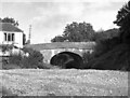
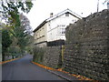
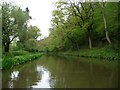
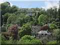
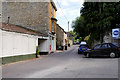
Photos of BA2 7HZ
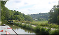
![Limpley Stoke Bridge [No 175] from the south in BA2 7HZ](https://images.propbar.co.uk/images/geograph/44/81/4481643_120.jpg)
57 photos from this area
Area Information
Key information about the BA2 7HZ including its size, population, and administrative classification.
- Area Type
- Postcode
- Area Size
- 12.7 hectares
- Population
- 1604
- Population Density
- 321 people/km²
House Prices in BA2 7HZ
5
Properties
£757,500
Average Sold Price
£90,000
Lowest Price
£1,800,000
Highest Price
Showing 5 properties
| Address | Type | Beds | Baths | Last Sale Price | Last Sale Date | |
|---|---|---|---|---|---|---|
| Scotland Rocks, 1 Warminster Road, Monkton Combe, BA2 7HZ | Detached | 3 | 1 | £810,000 | Aug 2022 | |
| Monkton House, Warminster Road, Monkton Combe, BA2 7HZ | Detached | 5 | 7 | £1,800,000 | Jul 2015 | |
| Oakencliffe, 2 Warminster Road, Monkton Combe, BA2 7HZ | Land | 4 | 1 | £330,000 | Mar 2013 | |
| Glenhazel, 3 Warminster Road, Monkton Combe, BA2 7HZ | Detached | - | - | £90,000 | Jan 1996 | |
| Monkton Lodge, 5 Warminster Road, Monkton Combe, BA2 7HZ | house | - | - | - | - |
Energy Efficiency in BA2 7HZ
Amenities
Schools
| Rank | School | Type | Entry gender | Ages |
|---|
Explore more schools in this area
Go to Schools tabDemographics
Household Size
Two person
most common
Accommodation Type
Houses
most common
Tenure
82
majority
Ethnic Group
White
most common
Religion
N/A
most common
Household Composition
N/A
most common
Age
47
median
Adults (30-64 years)
most common
Household Deprivation
N/A
with no deprivation
NS-SEC
53
in Lower managerial occupations
Explore more demographic insights in this area
Go to Demographics tabPlanning
Planning Constraints
- Flood RiskPremium
- Ramsar Wetland SitesPremium
- Area of Outstanding Natural BeautyPremium
- Protected Nature ReservePremium
- Protected WoodlandPremium