Area Overview for BA2 6ZD
Photos of BA2 6ZD


Area Information
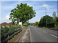
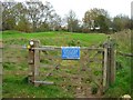
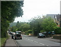
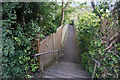
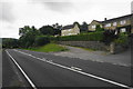
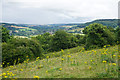
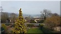
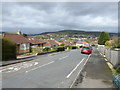
Living in BA2 6ZD means inhabiting a small, tightly knit residential cluster in Bath and North East Somerset, just 2 miles east of Bath city centre. With a population of 1,476 and a density of 290 people per square kilometre, this area balances compact living with a village feel. Situated on the River Avon’s south bank, it retains historical roots dating back to Saxon times and the Domesday Book. The Church of St Nicholas, a Grade II* listed 13th-century church, stands as a local landmark, alongside the Kennet and Avon Canal, opened in 1810. Daily life here is shaped by proximity to Bath’s cultural and commercial hubs, yet retains a quiet, rural charm. Residents benefit from nearby rail links, including Bath Spa and Freshford stations, and a mix of retail amenities. The area’s low crime risk and absence of environmental constraints make it appealing for families seeking stability without sacrificing access to urban opportunities.
- Area Type
- Postcode
- Area Size
- Not available
- Population
- 1476
- Population Density
- 290 people/km²
The property market in BA2 6ZD is characterised by high homeownership (87%) and a predominance of houses, indicating a largely owner-occupied area rather than a rental market. This suggests a stable, long-term resident base with limited turnover. The small size of the postcode area, combined with the focus on houses, may mean that buyers should consider nearby regions for more options. The presence of houses rather than flats or apartments aligns with the demographic profile of middle-aged residents, many of whom may be families or professionals seeking space. Given the area’s proximity to Bath, properties here could appeal to those desiring a quieter, semi-rural setting while retaining access to urban amenities.
House Prices in BA2 6ZD
No properties found in this postcode.
Energy Efficiency in BA2 6ZD
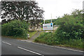
Residents of BA2 6ZD have access to a range of nearby amenities, including five retail outlets such as Spar Bathampton and Co-op University of, offering everyday shopping needs. The area is served by five rail stations, including Bath Spa and Freshford, facilitating easy travel to Bath and beyond. The Kennet and Avon Canal, which runs through the parish, adds a scenic element to the local environment, though specific parks or leisure facilities are not detailed in the data. The historical character of the area, including the Church of St Nicholas and Bathampton Weir, contributes to a distinct sense of place. These amenities provide practical convenience while preserving the village’s traditional charm.
Amenities
Schools
The nearest school to BA2 6ZD is Bathampton Primary School, a primary school with an Ofsted rating of ‘good’. This single school serves the local community, offering education for younger children. The absence of secondary schools in the immediate area means families may need to consider commuting to nearby towns like Bath or Bathampton for secondary education. However, the ‘good’ rating at Bathampton Primary School indicates a reliable foundation for early education. The school’s proximity to the area underscores its role as a community anchor, supporting local families with accessible, quality schooling.
| Rank | School | Type | Entry gender | Ages |
|---|
Explore more schools in this area
Go to Schools tabDemographics
The community in BA2 6ZD is predominantly middle-aged, with a median age of 47 and most residents falling within the 30–64 age range. Homeownership is high at 87%, reflecting a stable, long-term population. The majority of properties are houses, suggesting a preference for family-friendly or semi-detached living. The predominant ethnic group is White, though no specific diversity statistics are provided. The area’s population density of 290 people per square kilometre indicates a moderate balance between open space and residential density. This profile suggests a community of established residents, likely professionals or retirees, with limited turnover. The absence of explicit deprivation data means quality of life is inferred from amenities like schools, transport, and safety metrics, which are all rated positively.
Household Size
Accommodation Type
Tenure
Ethnic Group
Religion
Household Composition
Age
Household Deprivation
NS-SEC
Explore more demographic insights in this area
Go to Demographics tabPlanning
Planning Constraints
- Flood RiskPremium
- Ramsar Wetland SitesPremium
- Area of Outstanding Natural BeautyPremium
- Protected Nature ReservePremium
- Protected WoodlandPremium