Area Overview for BA2 6YS
Photos of BA2 6YS

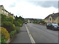
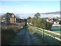
![Folly Footbridge [No 185], from the east in BA2 6YS](https://images.propbar.co.uk/images/geograph/44/82/4482628_120.jpg)
Area Information
Living in BA2 6YS places you in a compact residential cluster within Bath and North East Somerset, a region defined by its historic charm and urban refinement. With a population of 4,214 and a density of 1,522 people per square kilometre, this area is tightly woven into the fabric of Bath’s broader urban landscape. Centred around the BA1 postcode, it lies east of central Bath, across the River Avon, and is steeped in history, from its medieval origins as “Wiche” to its 18th-century Georgian development. The area’s character is marked by elegant Bath stone architecture, streets like Great Pulteney Street, and landmarks such as Pulteney Bridge. Daily life here balances proximity to cultural and educational hubs with a sense of community. Young adults dominate the demographic, reflecting a dynamic, forward-looking population. The area’s mix of independent shops, rail access, and proximity to the University of Bath makes it appealing for students, professionals, and families seeking a blend of tradition and modernity.
- Area Type
- Postcode
- Area Size
- Not available
- Population
- 4214
- Population Density
- 1522 people/km²
The property market in BA2 6YS is dominated by owner-occupied homes, with 86% of residents living in properties they own. This contrasts with areas where rental markets dominate, indicating a focus on long-term residency and investment. The accommodation type is primarily houses, which is notable in a postcode area of this size. This suggests a mix of family homes and smaller residences, potentially catering to both young professionals and growing families. The high home ownership rate may reflect the area’s appeal as a stable, low-risk location, supported by its proximity to educational institutions like the University of Bath and its well-connected transport links. For buyers, this means a competitive market with limited turnover, requiring careful consideration of property availability and long-term value. The compact nature of the area also means that immediate surroundings are critical for assessing property potential.
House Prices in BA2 6YS
No properties found in this postcode.
Energy Efficiency in BA2 6YS
Life in BA2 6YS is shaped by its proximity to retail, dining, and transport hubs. The area’s retail offerings include major chains like Tesco Bathwick, Morrisons Daily, and Morrisons Lansdown, providing access to groceries, household goods, and convenience services. Rail stations such as Bath Spa and Freshford offer easy links to Bath’s cultural centres, employment hubs, and beyond. While specific parks or leisure facilities are not detailed in the data, the area’s integration into Bath’s urban fabric suggests access to green spaces and recreational opportunities nearby. The presence of the University of Bath and independent schools also contributes to a lively, diverse community. The compact nature of the postcode means amenities are within practical reach, fostering a convenient, connected lifestyle. Residents benefit from a balance of local services and broader regional connectivity, ideal for those seeking both autonomy and accessibility.
Amenities
Schools
Residents of BA2 6YS have access to a range of educational institutions, from primary to higher education. Bathwick St Mary Church of England Primary School and Bathwick St Mary Church School (an academy with a good Ofsted rating) provide local primary education, while King Edward’s School offers independent secondary education. The University of Bath is also nearby, adding to the area’s academic vibrancy. This mix of school types means families can choose between state-funded options with strong ratings or independent schools with different pedagogical approaches. The presence of the University of Bath also ensures a steady flow of students and academic resources, potentially influencing local amenities and community dynamics. For parents, the combination of a good-rated academy and independent schooling offers flexibility, though the specific needs of children will determine the best fit.
| Rank | School | Type | Entry gender | Ages |
|---|
Explore more schools in this area
Go to Schools tabDemographics
The population of BA2 6YS is overwhelmingly young, with a median age of 22 and 86% of residents owning their homes. This suggests a community rooted in stability, with a strong presence of young adults aged 15–29. The predominant ethnic group is White, and the accommodation type is primarily houses, indicating a mix of family homes and smaller dwellings. The high home ownership rate aligns with a demographic that values long-term investment in property. With such a young population, the area likely sees frequent turnover, though the low crime risk score of 93 (a 100-scale where lower is safer) suggests a secure environment. The density of 1,522 people per square kilometre implies a compact, interconnected community, though the lack of explicit data on deprivation means quality of life remains inferred from the safety and infrastructure metrics provided.
Household Size
Accommodation Type
Tenure
Ethnic Group
Religion
Household Composition
Age
Household Deprivation
NS-SEC
Explore more demographic insights in this area
Go to Demographics tabPlanning
Planning Constraints
- Flood RiskPremium
- Ramsar Wetland SitesPremium
- Area of Outstanding Natural BeautyPremium
- Protected Nature ReservePremium
- Protected WoodlandPremium