Area Overview for BA2 6XW
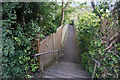
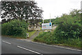
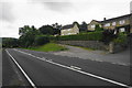
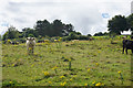
Photos of BA2 6XW

Area Information
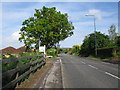
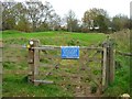
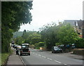
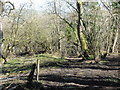
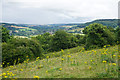
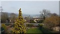
BA2 6XW is a small, tightly knit residential postcode area in Bath and North East Somerset, situated on the south bank of the River Avon. With a population of 1,476 and a density of 290 people per square kilometre, it reflects a compact, village-like character. The area lies approximately 2 miles east-northeast of Bath city centre, offering proximity to urban amenities while retaining a distinct rural charm. Historically, Bathampton — the village within this postcode — has roots dating back to Saxon times, with landmarks like the 13th-century Church of St Nicholas and the ancient Bathampton Weir. Daily life here balances quiet residential living with access to Bath’s cultural and commercial hubs. The area’s low population density and limited development suggest a focus on established, long-term residents. Its proximity to the Kennet and Avon Canal and the River Avon adds to its scenic appeal, though the small size of the postcode means most residents live within a short walk of local shops, schools, and transport links.
- Area Type
- Postcode
- Area Size
- Not available
- Population
- 1476
- Population Density
- 290 people/km²
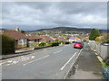
The property market in BA2 6XW is dominated by owner-occupied homes, with 87% of properties owned by residents rather than rented. This high rate of home ownership points to a community where long-term residency is common, likely reflecting the area’s historical character and limited new development. The accommodation type is predominantly houses, which aligns with the village’s traditional layout and smaller scale. This suggests a market where buyers seeking semi-detached or detached homes may find limited options, as the postcode covers a small cluster of properties. The proximity to Bath city centre, just 2 miles away, could make this area attractive to those seeking a quieter base with access to urban amenities. However, the small size of the postcode means buyers should consider nearby areas for more housing stock.
House Prices in BA2 6XW
No properties found in this postcode.
Energy Efficiency in BA2 6XW
The lifestyle in BA2 6XW is shaped by its small-scale residential character and proximity to Bath’s amenities. Nearby retail options include Spar Bathampton, Co-op University of, and Co-op Larkhall, offering everyday shopping needs. The area’s historical significance is reflected in landmarks like the Church of St Nicholas and Bathampton Weir, which contribute to a sense of local heritage. For leisure, the Kennet and Avon Canal and River Avon provide opportunities for walking or cycling. The presence of multiple railway stations within practical reach enhances connectivity, allowing residents to access Bath’s cultural venues, healthcare facilities, and employment hubs. While the area lacks large-scale amenities, its compact size ensures that essential services are within easy reach, fostering a self-contained yet connected lifestyle.
Amenities
Schools
The nearest school to BA2 6XW is Bathampton Primary School, a primary school with an Ofsted rating of ‘good’. This school serves the local community, providing education for younger children in the area. The absence of secondary schools nearby means families may need to look to Bath or surrounding towns for secondary education. The presence of a primary school with a positive rating is a key consideration for families prioritising local schooling. Given the area’s small size and the school’s proximity, it is likely that most residents within BA2 6XW rely on this institution. The lack of additional schools suggests that parents may need to factor in commuting time for older children, though the area’s transport links could mitigate this.
| Rank | School | Type | Entry gender | Ages |
|---|
Explore more schools in this area
Go to Schools tabDemographics
The population of BA2 6XW is predominantly middle-aged, with a median age of 47 and the most common age range being adults aged 30–64. This suggests a community of families and older residents, with 87% of homes owned outright, indicating a stable, settled population. The area is characterised by houses rather than flats, reflecting a preference for traditional residential properties. The predominant ethnic group is White, though specific data on diversity is not provided. The age profile and high home ownership rate suggest a community with long-term residency and limited turnover. The absence of specific deprivation data means the quality of life here cannot be assessed in terms of socioeconomic challenges, but the low crime score (87/100) and minimal environmental risks imply a generally secure and low-stress environment.
Household Size
Accommodation Type
Tenure
Ethnic Group
Religion
Household Composition
Age
Household Deprivation
NS-SEC
Explore more demographic insights in this area
Go to Demographics tabPlanning
Planning Constraints
- Flood RiskPremium
- Ramsar Wetland SitesPremium
- Area of Outstanding Natural BeautyPremium
- Protected Nature ReservePremium
- Protected WoodlandPremium