Area Overview for BA2 6TW
Photos of BA2 6TW
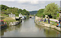
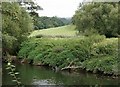
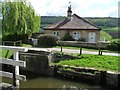
![Bathampton Swing Bridge [No 182] from the south in BA2 6TW](https://images.propbar.co.uk/images/geograph/44/86/4486893_120.jpg)
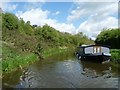
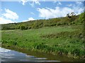
53 photos from this area
Area Information
Key information about the BA2 6TW including its size, population, and administrative classification.
- Area Type
- Postcode
- Area Size
- 8.9 hectares
- Population
- 1476
- Population Density
- 290 people/km²
House Prices in BA2 6TW
2
Properties
£193,000
Average Sold Price
£193,000
Lowest Price
£193,000
Highest Price
Showing 2 properties
| Address | Type | Beds | Baths | Last Sale Price | Last Sale Date | |
|---|---|---|---|---|---|---|
| Canal Cottage, Tow Path Kennet And Avon Canal, Bathampton, Bath, BA2 6TW | house | - | - | £193,000 | Sep 1995 | |
| Parcel 4587, Warleigh Lane, Bathford, Bath, BA2 6TW | Farm | - | - | - | - |
Energy Efficiency in BA2 6TW
Amenities
Schools
| Rank | School | Type | Entry gender | Ages |
|---|
Explore more schools in this area
Go to Schools tabDemographics
Household Size
Two person
most common
Accommodation Type
Houses
most common
Tenure
87
majority
Ethnic Group
White
most common
Religion
N/A
most common
Household Composition
N/A
most common
Age
47
median
Adults (30-64 years)
most common
Household Deprivation
N/A
with no deprivation
NS-SEC
55
in Lower managerial occupations
Explore more demographic insights in this area
Go to Demographics tabPlanning
Planning Constraints
- Flood RiskPremium
- Ramsar Wetland SitesPremium
- Area of Outstanding Natural BeautyPremium
- Protected Nature ReservePremium
- Protected WoodlandPremium