Area Overview for BA2 6TS
Photos of BA2 6TS
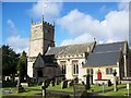
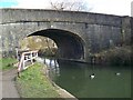

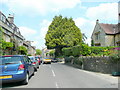
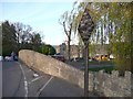
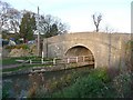
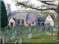
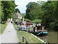
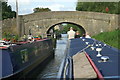
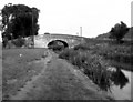

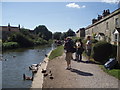
100 photos from this area
Area Information
Key information about the BA2 6TS including its size, population, and administrative classification.
- Area Type
- Postcode
- Area Size
- 24.8 hectares
- Population
- 1556
- Population Density
- 311 people/km²
House Prices in BA2 6TS
11
Properties
£1,800,000
Average Sold Price
£1,800,000
Lowest Price
£1,800,000
Highest Price
Showing 11 properties
| Address | Type | Beds | Baths | Last Sale Price | Last Sale Date | |
|---|---|---|---|---|---|---|
| Bathampton Manor, Mill Lane, Bathampton, Bath, BA2 6TS | house | 1 | - | £1,800,000 | Oct 2022 | |
| The Annexe, Garden House, Mill Lane, Bathampton, Bath, BA2 6TS | Flat | - | - | - | - | |
| Caravan, New Leaf Farm, Mill Lane, Bathampton, Bath, BA2 6TS | Mobile Home | - | - | - | - | |
| Beefeater Restaurant, Bathampton Mill, Mill Lane, Bathampton, Bath, BA2 6TS | Restaurant | - | - | - | - | |
| Agricultural Building, New Leaf Farm, Mill Lane, Bathampton, Bath, BA2 6TS | Farm | - | - | - | - | |
| Flat At, Beefeater Restaurant, Mill Lane, Bathampton, Bath, BA2 6TS | Flat | - | - | - | - | |
| Manor Barn, Mill Lane, Bathampton, Bath, BA2 6TS | Semi-detached | - | - | - | - | |
| Garden House, Mill Lane, Bathampton, Bath, BA2 6TS | Semi-detached | - | - | - | - | |
| The Garden Cottage, Mill Lane, Bathampton, Bath, BA2 6TS | house | - | - | - | - | |
| The Flat, Bathampton Manor, Mill Lane, Bathampton, Bath, BA2 6TS | Flat | - | - | - | - |
Page 1 of 2
Energy Efficiency in BA2 6TS
Amenities
Schools
| Rank | School | Type | Entry gender | Ages |
|---|
Explore more schools in this area
Go to Schools tabDemographics
Household Size
Family (3-5 people)
most common
Accommodation Type
Houses
most common
Tenure
70
majority
Ethnic Group
White
most common
Religion
N/A
most common
Household Composition
N/A
most common
Age
47
median
Adults (30-64 years)
most common
Household Deprivation
N/A
with no deprivation
NS-SEC
49
in Lower managerial occupations
Explore more demographic insights in this area
Go to Demographics tabPlanning
Planning Constraints
- Flood RiskPremium
- Ramsar Wetland SitesPremium
- Area of Outstanding Natural BeautyPremium
- Protected Nature ReservePremium
- Protected WoodlandPremium