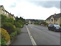
Area Overview for BA2 6RN
Photos of BA2 6RN
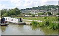

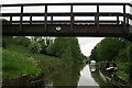
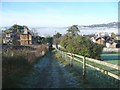
![Folly Footbridge [No 185], from the east in BA2 6RN](https://images.propbar.co.uk/images/geograph/44/82/4482628_120.jpg)
69 photos from this area
Area Information
Key information about the BA2 6RN including its size, population, and administrative classification.
- Area Type
- Postcode
- Area Size
- 10.5 hectares
- Population
- 1476
- Population Density
- 290 people/km²
House Prices in BA2 6RN
18
Properties
£411,242
Average Sold Price
£73,000
Lowest Price
£675,000
Highest Price
Showing 18 properties
| Address | Type | Beds | Baths | Last Sale Price | Last Sale Date | |
|---|---|---|---|---|---|---|
| 13 St Georges Hill, Bathampton, Bath, BA2 6RN | house | - | - | £460,000 | Jul 2022 | |
| 15 St Georges Hill, Bathampton, Bath, BA2 6RN | Semi-detached | 3 | 2 | £675,000 | Feb 2022 | |
| 3 St Georges Hill, Bathampton, Bath, BA2 6RN | Detached | 3 | 1 | £629,500 | Sep 2021 | |
| 14 St Georges Hill, Bathampton, Bath, BA2 6RN | Semi-detached | 3 | - | £379,950 | Jan 2017 | |
| 11 St Georges Hill, Bathampton, Bath, BA2 6RN | house | - | - | £250,000 | Oct 2006 | |
| 9 St Georges Hill, Bathampton, Bath, BA2 6RN | Semi-detached | - | - | £73,000 | Apr 1995 | |
| 1 St Georges Hill, Bathampton, Bath, BA2 6RN | Semi-detached | 3 | 1 | - | - | |
| 5 St Georges Hill, Bathampton, Bath, BA2 6RN | Semi-detached | 3 | 2 | - | - | |
| 1A St Georges Hill, Bathampton, Bath, BA2 6RN | Semi-detached | 2 | 1 | - | - | |
| 8 St Georges Hill, Bathampton, Bath, BA2 6RN | Semi-detached | 4 | 1 | - | - |
Page 1 of 2
Energy Efficiency in BA2 6RN
Amenities
Schools
| Rank | School | Type | Entry gender | Ages |
|---|
Explore more schools in this area
Go to Schools tabDemographics
Household Size
Two person
most common
Accommodation Type
Houses
most common
Tenure
87
majority
Ethnic Group
White
most common
Religion
N/A
most common
Household Composition
N/A
most common
Age
47
median
Adults (30-64 years)
most common
Household Deprivation
N/A
with no deprivation
NS-SEC
55
in Lower managerial occupations
Explore more demographic insights in this area
Go to Demographics tabPlanning
Planning Constraints
- Flood RiskPremium
- Ramsar Wetland SitesPremium
- Area of Outstanding Natural BeautyPremium
- Protected Nature ReservePremium
- Protected WoodlandPremium