Area Overview for BA2 6JF
Photos of BA2 6JF
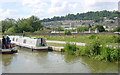

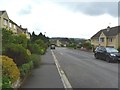
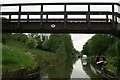
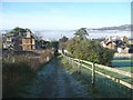
![Folly Footbridge [No 185], from the east in BA2 6JF](https://images.propbar.co.uk/images/geograph/44/82/4482628_120.jpg)
Area Information
Living in BA2 6JF means being part of a tightly knit residential cluster within the Bath and North East Somerset area. The postcode covers just 1.1 hectares, housing 1,497 people in a high-density layout. Situated east of central Bath across the River Avon, the area is steeped in history, with origins tracing back to the Domesday Book. Its character is defined by 18th- and 19th-century Georgian architecture, including elegant Bath stone buildings along streets like Great Pulteney Street. The proximity to Bath’s cultural and historical landmarks, such as Pulteney Bridge and St Mary’s Churchyard, offers residents easy access to heritage and urban amenities. Daily life here is shaped by a mature population, with a median age of 47, and a strong focus on home ownership. The area’s compact size means residents are within walking distance of Bath’s main attractions, while nearby rail stations provide swift connections to surrounding towns. BA2 6JF is ideal for those seeking a blend of historical charm, urban convenience, and a stable, community-oriented environment.
- Area Type
- Postcode
- Area Size
- 1.1 hectares
- Population
- 1497
- Population Density
- 2941 people/km²
The property market in BA2 6JF is dominated by owner-occupied homes, with 73% of residents living in houses rather than flats or rental properties. This reflects the area’s historic development as a Georgian residential district, where detached and semi-detached houses are the norm. The compact size of the postcode—just 1.1 hectares—means the housing stock is limited, and properties are likely to be in high demand due to their proximity to Bath’s amenities. Buyers should consider the area’s small footprint, which may mean limited availability of new builds or larger homes. The focus on houses suggests a market tailored to families or individuals seeking traditional, well-constructed properties. Proximity to Bath’s transport links and cultural hubs adds to the appeal, though the small size of the area means buyers must look closely at immediate surroundings for additional options.
House Prices in BA2 6JF
Showing 4 properties
| Address | Type | Beds | Baths | Last Sale Price | Last Sale Date | |
|---|---|---|---|---|---|---|
| First Floor 101 117, Darlington Court, Sydney Road, Bathwick, Bath, BA2 6JF | Terraced | 4 | 2 | - | - | |
| Lower Ground Floor, Darlington Court, Sydney Road, Bathwick, Bath, BA2 6JF | Flat | - | - | - | - | |
| Master Wing Ground Floor, Darlington Court, Sydney Road, Bathwick, Bath, BA2 6JF | Flat | - | - | - | - | |
| Second Floor 201 208, Darlington Court, Sydney Road, Bathwick, Bath, BA2 6JF | Flat | - | - | - | - |
Energy Efficiency in BA2 6JF
Residents of BA2 6JF have access to a range of amenities within practical reach, including five retail outlets such as Tesco Bathwick and Morrisons Daily. These shops provide essential grocery and convenience services, reducing the need for long journeys. The area’s proximity to Bath’s historic and cultural sites, like Pulteney Bridge and St Mary’s Churchyard, adds to its charm, offering opportunities for leisure and exploration. The nearby rail stations—Bath Spa, Oldfield Park, and Freshford—connect residents to broader networks, facilitating travel to work, shopping, or social events. The compact size of the postcode means the lifestyle is centred around Bath’s urban offerings, with a focus on convenience and historical character. While the data does not specify dining or park options, the presence of retail and transport hubs suggests a functional, community-oriented environment.
Amenities
Schools
The only school explicitly listed near BA2 6JF is Lime Grove Special School, which provides education for students with specific needs. No other schools are mentioned in the data, meaning families may need to look beyond the immediate postcode for mainstream education options. The presence of a special school suggests the area may cater to households with children requiring tailored support, though it does not indicate the availability of primary or secondary schools within walking distance. Parents considering BA2 6JF should investigate nearby schools in Bath and North East Somerset, as the data does not provide details on their Ofsted ratings or academic performance. The lack of comprehensive school data means prospective buyers must conduct further research to assess educational provision for their children.
| Rank | School | Type | Entry gender | Ages |
|---|
Explore more schools in this area
Go to Schools tabDemographics
The community in BA2 6JF is predominantly composed of adults aged 30–64, with a median age of 47. Home ownership is high at 73%, reflecting a stable, long-term resident base. The area is primarily occupied by houses, aligning with the Georgian architectural character of the district. The predominant ethnic group is White, which is consistent with broader trends in Bath and North East Somerset. The population density of 131,682 people per square kilometre indicates a compact, residential layout, typical of urban areas within Bath’s conservation zones. This density supports a sense of community but may limit space for larger families. The absence of specific deprivation data means the quality of life is inferred from the area’s safety, infrastructure, and access to services. The demographic profile suggests a mix of professionals and retirees, with a focus on established households rather than transient populations.
Household Size
Accommodation Type
Tenure
Ethnic Group
Religion
Household Composition
Age
Household Deprivation
NS-SEC
Explore more demographic insights in this area
Go to Demographics tabPlanning
Planning Constraints
- Flood RiskPremium
- Ramsar Wetland SitesPremium
- Area of Outstanding Natural BeautyPremium
- Protected Nature ReservePremium
- Protected WoodlandPremium