Area Overview for BA2 6JA
Photos of BA2 6JA

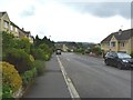
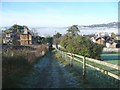
![Folly Footbridge [No 185], from the east in BA2 6JA](https://images.propbar.co.uk/images/geograph/44/82/4482628_120.jpg)
Area Information
Living in BA2 6JA offers a compact, residential experience within the broader Bathwick area of Bath and North East Somerset. The postcode covers 10.7 hectares, housing 4,214 people in a densely populated cluster with a density of 1,522 people per square kilometre. This area is part of Bathwick Ward, historically a small village separated from Bath’s core until its urbanisation in the 18th century. Today, it retains a distinct character defined by Georgian architecture along streets like Great Pulteney Street and Sydney Place. The area’s proximity to the River Avon and landmarks such as Pulteney Bridge adds to its appeal. With a median age of 22 and a population skewed towards young adults, BA2 6JA is a dynamic, youthful community. Its compact size means amenities and services are within easy reach, while its integration into Bath’s urban fabric ensures access to cultural and historical sites. For those seeking a blend of historic charm and modern convenience, this area offers a focused, manageable living environment.
- Area Type
- Postcode
- Area Size
- 10.7 hectares
- Population
- 4214
- Population Density
- 1522 people/km²
The property market in BA2 6JA is largely owner-occupied, with 86% of homes owned by residents rather than rented. This suggests a stable, established community where long-term residency is common. The area is dominated by houses rather than flats, reflecting its residential, family-oriented character. Given the small size of the postcode (10.7 hectares) and its integration into Bath’s urban fabric, the housing stock is limited, making it a niche market for buyers seeking a compact, historic location. Proximity to Bath’s amenities and transport links likely enhances its appeal, though the small area means buyers may need to consider nearby regions for more options. The high home ownership rate also indicates strong local attachment, with properties likely retaining value due to their historic and architectural significance.
House Prices in BA2 6JA
Showing 1 properties
| Address | Type | Beds | Baths | Last Sale Price | Last Sale Date | |
|---|---|---|---|---|---|---|
| King Edwards Junior School, North Road, Bathwick, Bath, BA2 6JA | Industrial | - | - | - | - |
Energy Efficiency in BA2 6JA
The lifestyle in BA2 6JA is shaped by its proximity to retail and transport hubs. Nearby shops like Tesco Bathwick, Morrisons Daily, and Morrisons Lansdown provide easy access to groceries and daily necessities. The five railway stations, including Bath Spa and Freshford, connect residents to Bath’s cultural and commercial centres, as well as broader regional networks. The area’s compact size ensures amenities are within walking or short driving distance. Historically, Bathwick’s Georgian architecture and landmarks like Pulteney Bridge contribute to its character, though modern convenience is prioritised. For residents, this balance of practicality and heritage supports a lifestyle that is both functional and rooted in local history.
Amenities
Schools
BA2 6JA is served by a mix of school types, offering options for families. Bathwick St Mary Church of England Primary School provides state education for younger children, while King Edward’s School is an independent institution catering to older students. The University of Bath, though not a traditional school, contributes to the area’s educational landscape. Additionally, Bathwick St Mary Church School, an academy with a ‘good’ Ofsted rating, offers further state-led education. This diversity allows families to choose between state and independent schooling, ensuring flexibility. The presence of both primary and secondary options, along with the university, supports a well-rounded educational environment. However, the specific catchment areas and school performance data are not detailed, so prospective families should verify eligibility and outcomes independently.
| Rank | School | Type | Entry gender | Ages |
|---|
Explore more schools in this area
Go to Schools tabDemographics
BA2 6JA’s population of 4,214 is predominantly young, with a median age of 22 and the majority (15–29 years) in the early stages of their careers or education. Home ownership is high, with 86% of residents living in owner-occupied properties, reflecting a stable, long-term community. The area is characterised by houses rather than flats, aligning with its residential, family-friendly profile. The predominant ethnic group is White, though specific diversity metrics are not provided. The high population density of 1,522 people per square kilometre suggests a compact, interconnected neighbourhood where social interaction is frequent. This density, combined with the young demographic, indicates a vibrant, active community. However, the absence of detailed data on deprivation or income levels means broader implications for quality of life remain unexplored.
Household Size
Accommodation Type
Tenure
Ethnic Group
Religion
Household Composition
Age
Household Deprivation
NS-SEC
Explore more demographic insights in this area
Go to Demographics tabPlanning
Planning Constraints
- Flood RiskPremium
- Ramsar Wetland SitesPremium
- Area of Outstanding Natural BeautyPremium
- Protected Nature ReservePremium