Area Overview for BA2 3YL
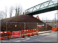
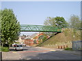
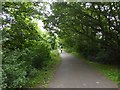
Photos of BA2 3YL

Area Information
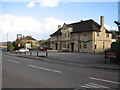
BA2 3YL is a small residential postcode nestled within Bath, a city renowned for its Roman heritage and UNESCO World Heritage status. With a population of 1,582, this area reflects post-war urban planning, shaped by the Moorlands Estate—a pioneering housing development built after World War II. The estate, constructed between 1946 and 1949, features two-storey family homes and flats designed with open-plan layouts and Bath stone, blending functionality with local character. Residents benefit from proximity to Bath’s historic centre, which offers cultural and recreational opportunities. The area’s youthful demographic—median age 22, with 50% of the population aged 15–29—suggests a dynamic community. Daily life here is defined by a mix of residential tranquillity and easy access to Bath’s amenities, from retail to transport hubs. The postcode’s small size means it is tightly integrated with surrounding neighbourhoods, creating a cohesive living environment. Its history as a model for post-war housing underscores its enduring appeal, combining practicality with a sense of place.
- Area Type
- Postcode
- Area Size
- Not available
- Population
- Not available
- Population Density
- Not available
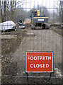
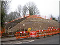
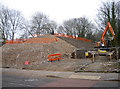
BA2 3YL is predominantly a house-based area, with 50% of properties owned by residents. This suggests a mix of owner-occupied homes and rental properties, though the exact proportion of rentals is not specified. The housing stock, largely comprising two-storey family homes built as part of the Moorlands Estate, reflects mid-20th-century design principles—open-plan layouts, good-sized gardens, and Bath stone construction. Given the area’s small size, the property market is likely limited in scale, with limited scope for new developments due to planning constraints. For buyers, this means a focus on existing stock, with potential for character homes that align with the estate’s historical significance. The proximity to Bath’s amenities may enhance property value, though the area’s compact nature means buyers should consider nearby neighbourhoods for broader options.
House Prices in BA2 3YL
No properties found in this postcode.
Energy Efficiency in BA2 3YL
Residents of BA2 3YL have access to a range of nearby amenities, including five retail outlets such as Morrisons Daily, Cook Bath, and Sainsburys Bath. These shops provide essential grocery and household services within practical reach. The area’s rail network, with stations like Oldfield Park and Bath Spa, connects residents to Bath’s cultural and commercial hubs. A metro station at Bitton offers additional transport options. While the area itself is residential, its proximity to Bath’s historic centre means residents can enjoy the city’s attractions, from museums to dining. The Moorlands Estate’s design, with open spaces and recreational areas, supports an active lifestyle. However, the immediate vicinity lacks large parks or leisure facilities, requiring trips to nearby locations for more extensive amenities. The combination of retail, transport, and historical context creates a convenient yet compact living environment.
Amenities
Schools
The nearest school to BA2 3YL is St John’s Catholic Primary School, which has an Ofsted rating of ‘good’. This primary school serves the local community, offering education for younger children. The presence of a single primary school suggests that families may need to travel slightly beyond the immediate area for secondary education, though Bath’s broader network of schools remains accessible. The school’s ‘good’ rating indicates a satisfactory standard of teaching and facilities, which is important for parents prioritising educational quality. Given the area’s young population, the school plays a central role in daily life, fostering a sense of community. However, the absence of secondary schools nearby means families should consider proximity to other educational institutions when evaluating the area.
| Rank | School | Type | Entry gender | Ages |
|---|
Explore more schools in this area
Go to Schools tabDemographics
BA2 3YL has a median age of 22, with the majority of residents aged 15–29. This reflects a young adult population, likely drawn to the area’s affordability and proximity to Bath’s opportunities. Home ownership stands at 50%, suggesting a balanced mix of owner-occupied and rental properties. The primary accommodation type is houses, indicating a focus on family-friendly housing rather than flats or apartments. The predominant ethnic group is White, though specific diversity data is not provided. The age profile implies a community centred on students, young professionals, or families starting out. With 50% of residents owning their homes, the area may offer a stable environment for those seeking long-term residency. The youthful demographic also suggests a vibrant social scene, though the lack of detailed diversity metrics means the full cultural makeup remains unexplored.
Household Size
Accommodation Type
Tenure
Ethnic Group
Religion
Household Composition
Age
Household Deprivation
NS-SEC
Explore more demographic insights in this area
Go to Demographics tabPlanning
Planning Constraints
- Flood RiskPremium
- Ramsar Wetland SitesPremium
- Area of Outstanding Natural BeautyPremium
- Protected Nature ReservePremium
- Protected WoodlandPremium