Area Overview for BA2 3YB
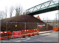
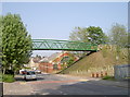
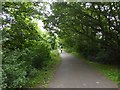
Photos of BA2 3YB

Area Information
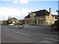
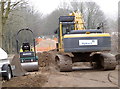
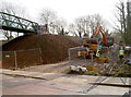
BA2 3YB is a small residential cluster in Bath, Somerset, with a population of 1,582. It lies within the Moorlands Ward, a post-war housing development that reflects mid-20th-century urban planning. The area’s character is defined by its two-storey family homes and flats, many built in Bath stone, which blend practicality with local heritage. Young adults aged 15–29 form the largest demographic, creating a dynamic, youthful community. Daily life here is shaped by proximity to Bath’s cultural and historical landmarks, including its UNESCO-listed Roman baths. The Moorlands Estate, constructed after World War II, remains a central feature, offering open layouts, communal spaces, and a legacy of public housing innovation. Residents benefit from easy access to rail networks, retail hubs, and a primary school with a good Ofsted rating. The area’s compact size and mix of modern infrastructure and historical context make it appealing to those seeking a balance between urban convenience and a sense of community.
- Area Type
- Postcode
- Area Size
- Not available
- Population
- Not available
- Population Density
- Not available
BA2 3YB’s property market is characterised by a 50% home ownership rate, with houses forming the dominant accommodation type. This suggests a balance between owner-occupied properties and rental stock, though the small area size means the housing stock is limited. The prevalence of houses, rather than flats, indicates a focus on family homes with private gardens and open-plan layouts, a legacy of the post-war Moorlands Estate design. For buyers, this means a niche market with limited scope for expansion. The area’s compact nature and proximity to Bath’s amenities make it attractive to those prioritising space and convenience. However, the small size also means competition for available properties, and buyers should consider the potential for long-term value growth in a historically significant location.
House Prices in BA2 3YB
No properties found in this postcode.
Energy Efficiency in BA2 3YB
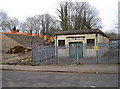
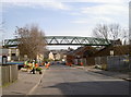
Residents of BA2 3YB have access to a range of amenities within practical reach. Retail options include Morrisons Daily, Cook Bath, and Sainsburys Bath, offering everyday shopping convenience. The area’s proximity to rail networks and the Bitton metro station ensures easy access to Bath’s cultural hubs, such as the Roman baths and museums. Recreational spaces like the Sandpits play area, built on former Moorlands Farm land, provide outdoor leisure for families. The Moorlands Estate itself, with its open-plan layouts and communal gardens, fosters a lifestyle centred on community interaction. This blend of retail, transport, and green spaces creates a balanced, convenient living environment.
Amenities
Schools
The nearest school to BA2 3YB is St John’s Catholic Primary School, which holds a ‘good’ Ofsted rating. This primary school serves the area’s young population, offering a structured educational environment aligned with Catholic values. The absence of secondary schools in the immediate vicinity means families may need to consider commuting to nearby Bath schools, though the primary school’s quality provides a solid foundation for early education. The school’s rating reflects its effectiveness in teaching and pastoral care, which is critical for young children. For families prioritising strong early education, St John’s offers a reliable option, though secondary schooling would require planning for broader access.
| Rank | School | Type | Entry gender | Ages |
|---|
Explore more schools in this area
Go to Schools tabDemographics
The population of BA2 3YB has a median age of 22, with 50% of residents aged 15–29. This young demographic shapes the area’s social fabric, with a focus on family-oriented living and community engagement. Home ownership stands at 50%, indicating a mix of owner-occupied and rental properties. The predominant accommodation type is houses, reflecting a preference for standalone living spaces. The majority of residents identify as White, though specific data on other ethnic groups is not provided. The low median age suggests a transient or growing population, potentially influenced by student or young professional migration. For quality of life, the absence of deprivation data means the area’s socioeconomic profile remains unquantified, but the presence of retail amenities and good transport links implies reasonable access to essential services.
Household Size
Accommodation Type
Tenure
Ethnic Group
Religion
Household Composition
Age
Household Deprivation
NS-SEC
Explore more demographic insights in this area
Go to Demographics tabPlanning
Planning Constraints
- Flood RiskPremium
- Ramsar Wetland SitesPremium
- Area of Outstanding Natural BeautyPremium
- Protected Nature ReservePremium
- Protected WoodlandPremium