Area Overview for BA2 2DH
Photos of BA2 2DH
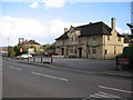

61 photos from this area
Area Information
Key information about the BA2 2DH including its size, population, and administrative classification.
- Area Type
- Postcode
- Area Size
- 1.1 hectares
- Population
- 1434
- Population Density
- 3794 people/km²
House Prices in BA2 2DH
27
Properties
£202,520
Average Sold Price
£45,000
Lowest Price
£433,000
Highest Price
Showing 27 properties
| Address | Type | Beds | Baths | Last Sale Price | Last Sale Date | |
|---|---|---|---|---|---|---|
| 25 Ashford Road, Moorlands, Bath, BA2 2DH | Terraced | 3 | 2 | £433,000 | Feb 2023 | |
| 15 Ashford Road, Moorlands, Bath, BA2 2DH | house | 2 | - | £270,000 | Sep 2022 | |
| 20 Ashford Road, Moorlands, Bath, BA2 2DH | Terraced | 3 | - | £320,000 | Jun 2022 | |
| 22 Ashford Road, Moorlands, Bath, BA2 2DH | Terraced | 2 | 1 | £267,000 | Dec 2020 | |
| 12 Ashford Road, Moorlands, Bath, BA2 2DH | Semi-detached | 3 | 1 | £296,250 | Apr 2018 | |
| 18 Ashford Road, Moorlands, Bath, BA2 2DH | Semi-detached | 3 | - | £179,100 | Jul 2013 | |
| 24 Ashford Road, Moorlands, Bath, BA2 2DH | Terraced | 5 | 2 | £195,000 | May 2012 | |
| 4 Ashford Road, Moorlands, Bath, BA2 2DH | house | 3 | - | £193,500 | Apr 2012 | |
| 17 Ashford Road, Moorlands, Bath, BA2 2DH | house | - | - | £174,000 | Nov 2009 | |
| 14 Ashford Road, Moorlands, Bath, BA2 2DH | Semi-detached | 5 | - | £215,000 | Oct 2006 |
Page 1 of 3
Energy Efficiency in BA2 2DH
Amenities
Schools
| Rank | School | Type | Entry gender | Ages |
|---|
Explore more schools in this area
Go to Schools tabDemographics
Household Size
One person
most common
Accommodation Type
Houses
most common
Tenure
49
majority
Ethnic Group
White
most common
Religion
N/A
most common
Household Composition
N/A
most common
Age
47
median
Adults (30-64 years)
most common
Household Deprivation
N/A
with no deprivation
NS-SEC
33
in Lower managerial occupations
Explore more demographic insights in this area
Go to Demographics tabPlanning
Planning Constraints
- Flood RiskPremium
- Ramsar Wetland SitesPremium
- Area of Outstanding Natural BeautyPremium
- Protected Nature ReservePremium
- Protected WoodlandPremium