Area Overview for BA2 2BT
Photos of BA2 2BT
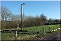

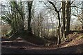
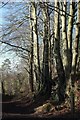
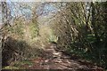


48 photos from this area
Area Information
Key information about the BA2 2BT including its size, population, and administrative classification.
- Area Type
- Postcode
- Area Size
- 5875 m²
- Population
- 1363
- Population Density
- 4898 people/km²
House Prices in BA2 2BT
26
Properties
£176,196
Average Sold Price
£57,590
Lowest Price
£365,000
Highest Price
Showing 26 properties
| Address | Type | Beds | Baths | Last Sale Price | Last Sale Date | |
|---|---|---|---|---|---|---|
| 16 Holly Drive, Odd Down, Bath, BA2 2BT | Terraced | 3 | 1 | £365,000 | Oct 2025 | |
| 18 Holly Drive, Odd Down, Bath, BA2 2BT | Terraced | 2 | 2 | £300,000 | Apr 2023 | |
| 3 Holly Drive, Odd Down, Bath, BA2 2BT | Semi-detached | 3 | 1 | £321,000 | Jul 2021 | |
| 2 Holly Drive, Odd Down, Bath, BA2 2BT | Semi-detached | 3 | 1 | £320,000 | Feb 2021 | |
| 12 Holly Drive, Odd Down, Bath, BA2 2BT | Terraced | 2 | 1 | £237,000 | Feb 2020 | |
| 8 Holly Drive, Odd Down, Bath, BA2 2BT | Semi-detached | 3 | 1 | £297,500 | Sep 2019 | |
| 9 Holly Drive, Odd Down, Bath, BA2 2BT | Terraced | 3 | 1 | £239,000 | Apr 2018 | |
| 25 Holly Drive, Odd Down, Bath, BA2 2BT | Semi-detached | 2 | 1 | £219,500 | Mar 2016 | |
| 24 Holly Drive, Odd Down, Bath, BA2 2BT | Terraced | 2 | 1 | £218,000 | Dec 2015 | |
| 4 Holly Drive, Odd Down, Bath, BA2 2BT | Semi-detached | 3 | 1 | £206,000 | Aug 2013 |
Page 1 of 3
Energy Efficiency in BA2 2BT
Amenities
Schools
| Rank | School | Type | Entry gender | Ages |
|---|
Explore more schools in this area
Go to Schools tabDemographics
Household Size
Family (3-5 people)
most common
Accommodation Type
Houses
most common
Tenure
51
majority
Ethnic Group
White
most common
Religion
N/A
most common
Household Composition
N/A
most common
Age
47
median
Adults (30-64 years)
most common
Household Deprivation
N/A
with no deprivation
NS-SEC
32
in Lower managerial occupations
Explore more demographic insights in this area
Go to Demographics tabPlanning
Planning Constraints
- Flood RiskPremium
- Ramsar Wetland SitesPremium
- Area of Outstanding Natural BeautyPremium
- Protected Nature ReservePremium
- Protected WoodlandPremium