Area Overview for BA2 1SH
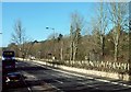
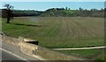
Photos of BA2 1SH
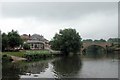
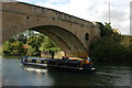
![Newbridge Railway Bridge [No 207], from the north-west in BA2 1SH](https://images.propbar.co.uk/images/geograph/44/83/4483738_120.jpg)
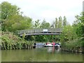
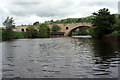
![New Bridge [No 208] from the north-west in BA2 1SH](https://images.propbar.co.uk/images/geograph/44/83/4483747_120.jpg)
73 photos from this area
Area Information
Key information about the BA2 1SH including its size, population, and administrative classification.
- Area Type
- Postcode
- Area Size
- 8.0 hectares
- Population
- 1602
- Population Density
- 2853 people/km²
House Prices in BA2 1SH
47
Properties
£132,791
Average Sold Price
£32,000
Lowest Price
£235,000
Highest Price
Showing 47 properties
| Address | Type | Beds | Baths | Last Sale Price | Last Sale Date | |
|---|---|---|---|---|---|---|
| 54 Redland Park, Twerton, Bath, BA2 1SH | house | 2 | - | £216,250 | Jan 2022 | |
| 78 Redland Park, Twerton, Bath, BA2 1SH | Terraced | 3 | 1 | £235,000 | May 2021 | |
| 52 Redland Park, Twerton, Bath, BA2 1SH | Flat | - | - | £130,000 | Aug 2020 | |
| 62 Redland Park, Twerton, Bath, BA2 1SH | Terraced | 3 | 1 | £217,500 | Oct 2018 | |
| 84 Redland Park, Twerton, Bath, BA2 1SH | Land | 2 | - | £140,000 | Jun 2017 | |
| 42 Redland Park, Twerton, Bath, BA2 1SH | Terraced | 2 | - | £169,950 | Oct 2015 | |
| 74 Redland Park, Twerton, Bath, BA2 1SH | Terraced | 4 | 1 | £150,000 | Jan 2015 | |
| 67 Redland Park, Twerton, Bath, BA2 1SH | house | 3 | - | £123,000 | Jul 2012 | |
| 66 Redland Park, Twerton, Bath, BA2 1SH | house | 3 | - | £130,000 | Apr 2011 | |
| 77 Redland Park, Twerton, Bath, BA2 1SH | Terraced | 3 | 1 | £120,000 | Jul 2009 |
Page 1 of 5
Energy Efficiency in BA2 1SH
Amenities
Schools
| Rank | School | Type | Entry gender | Ages |
|---|
Explore more schools in this area
Go to Schools tabDemographics
Household Size
One person
most common
Accommodation Type
Houses
most common
Tenure
36
majority
Ethnic Group
White
most common
Religion
N/A
most common
Household Composition
N/A
most common
Age
47
median
Adults (30-64 years)
most common
Household Deprivation
N/A
with no deprivation
NS-SEC
15
in Lower managerial occupations
Explore more demographic insights in this area
Go to Demographics tabPlanning
Planning Constraints
- Flood RiskPremium
- Ramsar Wetland SitesPremium
- Area of Outstanding Natural BeautyPremium
- Protected Nature ReservePremium
- Protected WoodlandPremium