Area Overview for BA2 1NF
Photos of BA2 1NF
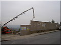
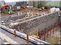
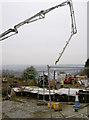
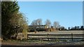
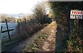
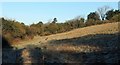
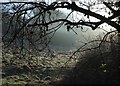
54 photos from this area
Area Information
Key information about the BA2 1NF including its size, population, and administrative classification.
- Area Type
- Postcode
- Area Size
- 1.2 hectares
- Population
- 1189
- Population Density
- 3949 people/km²
House Prices in BA2 1NF
27
Properties
£271,281
Average Sold Price
£57,500
Lowest Price
£520,000
Highest Price
Showing 27 properties
| Address | Type | Beds | Baths | Last Sale Price | Last Sale Date | |
|---|---|---|---|---|---|---|
| 122 The Hollow, Southdown, Bath, BA2 1NF | Detached | 3 | 2 | £500,000 | Dec 2025 | |
| 154 The Hollow, Southdown, Bath, BA2 1NF | Semi-detached | 3 | 2 | £520,000 | Dec 2024 | |
| 116 The Hollow, Southdown, Bath, BA2 1NF | Semi-detached | 3 | 1 | £467,500 | Oct 2024 | |
| 164 THE HOLLOW, Southdown, Bath, BA2 1NF | Semi-detached | 2 | 1 | £261,000 | Nov 2020 | |
| 134 The Hollow, Southdown, Bath, BA2 1NF | Semi-detached | 3 | 1 | £280,100 | Jul 2020 | |
| 130 The Hollow, Southdown, Bath, BA2 1NF | Semi-detached | 3 | 1 | £290,000 | Mar 2020 | |
| 146 The Hollow, Southdown, Bath, BA2 1NF | Semi-detached | 2 | 1 | £270,000 | Mar 2019 | |
| 140 The Hollow, Southdown, Bath, BA2 1NF | Semi-detached | 3 | 1 | £300,000 | Jan 2019 | |
| 166 The Hollow, Southdown, Bath, BA2 1NF | Bungalow | 2 | 1 | £268,000 | Dec 2018 | |
| 124 The Hollow, Southdown, Bath, BA2 1NF | Semi-detached | 3 | 1 | £370,000 | Jun 2017 |
Page 1 of 3
Energy Efficiency in BA2 1NF
Amenities
Schools
| Rank | School | Type | Entry gender | Ages |
|---|
Explore more schools in this area
Go to Schools tabDemographics
Household Size
Family (3-5 people)
most common
Accommodation Type
Houses
most common
Tenure
52
majority
Ethnic Group
White
most common
Religion
N/A
most common
Household Composition
N/A
most common
Age
47
median
Adults (30-64 years)
most common
Household Deprivation
N/A
with no deprivation
NS-SEC
26
in Lower managerial occupations
Explore more demographic insights in this area
Go to Demographics tabPlanning
Planning Constraints
- Flood RiskPremium
- Ramsar Wetland SitesPremium
- Area of Outstanding Natural BeautyPremium
- Protected Nature ReservePremium
- Protected WoodlandPremium