Area Overview for BA2 0QE
Photos of BA2 0QE
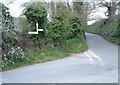
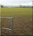
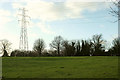
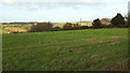
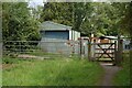
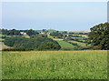
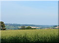
15 photos from this area
Area Information
Key information about the BA2 0QE including its size, population, and administrative classification.
- Area Type
- Postcode
- Area Size
- 17.4 hectares
- Population
- 2326
- Population Density
- 118 people/km²
House Prices in BA2 0QE
16
Properties
£480,500
Average Sold Price
£92,500
Lowest Price
£825,000
Highest Price
Showing 16 properties
| Address | Type | Beds | Baths | Last Sale Price | Last Sale Date | |
|---|---|---|---|---|---|---|
| Berlena, Durcott Lane, Camerton, Bath, BA2 0QE | Detached | 4 | 3 | £825,000 | Jun 2025 | |
| Bramley Cottage, Durcott Lane, Camerton, Bath, BA2 0QE | house | 6 | 2 | £728,500 | Jun 2023 | |
| Brenroy, Durcott Lane, Camerton, Bath, BA2 0QE | house | - | - | £550,000 | Jan 2019 | |
| Brooklands, Durcott Lane, Camerton, Bath, BA2 0QE | house | - | - | £490,000 | Jul 2016 | |
| 6 Durcott Lane, Camerton, Bath, BA2 0QE | Detached | 5 | 2 | £280,000 | Apr 2016 | |
| The Poppies, Durcott Lane, Camerton, Bath, BA2 0QE | Detached | - | - | £397,500 | Dec 2012 | |
| Eastwood, Durcott Lane, Camerton, Bath, BA2 0QE | Bungalow | 4 | 2 | £92,500 | Apr 2001 | |
| Spring Cottage, Durcott Lane, Camerton, Bath, BA2 0QE | Cottage | 3 | 1 | - | - | |
| Westwood, Durcott Lane, Camerton, Bath, BA2 0QE | Bungalow | 4 | - | - | - | |
| Ridgeway, Durcott Lane, Camerton, Bath, BA2 0QE | Detached | - | - | - | - |
Page 1 of 2
Energy Efficiency in BA2 0QE
Amenities
Schools
| Rank | School | Type | Entry gender | Ages |
|---|
Explore more schools in this area
Go to Schools tabDemographics
Household Size
Two person
most common
Accommodation Type
Houses
most common
Tenure
67
majority
Ethnic Group
White
most common
Religion
N/A
most common
Household Composition
N/A
most common
Age
22
median
Young Adults (15-29 years)
most common
Household Deprivation
N/A
with no deprivation
NS-SEC
17
in Lower managerial occupations
Explore more demographic insights in this area
Go to Demographics tabPlanning
Planning Constraints
- Flood RiskPremium
- Ramsar Wetland SitesPremium
- Area of Outstanding Natural BeautyPremium
- Protected Nature ReservePremium
- Protected WoodlandPremium