Area Overview for BA2 0DL
Photos of BA2 0DL
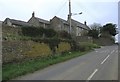
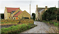
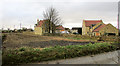
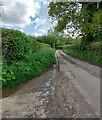
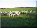
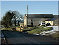

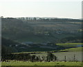
10 photos from this area
Area Information
Key information about the BA2 0DL including its size, population, and administrative classification.
- Area Type
- Postcode
- Area Size
- 33.3 hectares
- Population
- 2326
- Population Density
- 118 people/km²
House Prices in BA2 0DL
10
Properties
£380,000
Average Sold Price
£380,000
Lowest Price
£380,000
Highest Price
Showing 10 properties
| Address | Type | Beds | Baths | Last Sale Price | Last Sale Date | |
|---|---|---|---|---|---|---|
| Tunley Farm House, Tunley Hill, Camerton, Bath, BA2 0DL | Farm | 4 | - | £380,000 | Feb 2018 | |
| Keeper's Cottage, Tunley Farm, Tunley Hill, Camerton, Bath, BA2 0DL | Semi-detached | - | - | - | - | |
| Unit E9 Unoccupied Premises, Tunley Farm Estate, Tunley Hill, Camerton, Bath, BA2 0DL | Industrial | - | - | - | - | |
| Cheddar House, Tunley Farm, Tunley Hill, Camerton, Bath, BA2 0DL | Flat | - | - | - | - | |
| 1, Tunley View, Bath Road, Tunley, Bath, BA2 0DL | house | 3 | - | - | - | |
| 2, Tunley View, Bath Road, Tunley, Bath, BA2 0DL | house | 3 | 1 | - | - | |
| Sidelands, Tunley Farm, Tunley Hill, Camerton, Bath, BA2 0DL | Semi-detached | - | - | - | - | |
| The Brambles, Tunley Hill, Camerton, Bath, BA2 0DL | Terraced | - | - | - | - | |
| Unit N1, Natural Vitality, Tunley Farm Estate, Tunley Hill, Camerton, Bath, BA2 0DL | office_workshop | - | - | - | - | |
| Dairy Cottage, Tunley Hill, Camerton, Bath, BA2 0DL | Terraced | - | - | - | - |
Energy Efficiency in BA2 0DL
Amenities
Schools
| Rank | School | Type | Entry gender | Ages |
|---|
Explore more schools in this area
Go to Schools tabDemographics
Household Size
Two person
most common
Accommodation Type
Houses
most common
Tenure
67
majority
Ethnic Group
White
most common
Religion
N/A
most common
Household Composition
N/A
most common
Age
22
median
Young Adults (15-29 years)
most common
Household Deprivation
N/A
with no deprivation
NS-SEC
17
in Lower managerial occupations
Explore more demographic insights in this area
Go to Demographics tabPlanning
Planning Constraints
- Flood RiskPremium
- Ramsar Wetland SitesPremium
- Area of Outstanding Natural BeautyPremium
- Protected Nature ReservePremium
- Protected WoodlandPremium