Area Overview for BA2 0AF
Photos of BA2 0AF
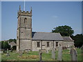
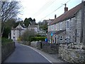
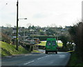
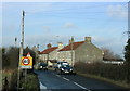
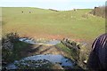
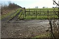
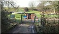
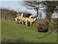
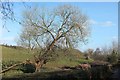
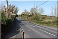
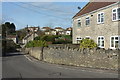
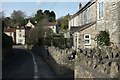
94 photos from this area
Area Information
Key information about the BA2 0AF including its size, population, and administrative classification.
- Area Type
- Postcode
- Area Size
- 1.2 hectares
- Population
- 1700
- Population Density
- 111 people/km²
House Prices in BA2 0AF
25
Properties
£311,625
Average Sold Price
£232,500
Lowest Price
£430,000
Highest Price
Showing 25 properties
| Address | Type | Beds | Baths | Last Sale Price | Last Sale Date | |
|---|---|---|---|---|---|---|
| Spindrift Court, The Mead, Farmborough, Bath, BA2 0AF | Bungalow | 5 | 2 | £430,000 | Jan 2018 | |
| Sunningbrook, The Mead, Farmborough, Bath, BA2 0AF | Detached | 3 | 1 | £274,000 | Dec 2014 | |
| Bakers Mead, The Mead, Farmborough, Bath, BA2 0AF | Semi-detached | 3 | - | £232,500 | Sep 2013 | |
| The Mead Bungalow, The Mead, Farmborough, Bath, BA2 0AF | Detached | 3 | 2 | £310,000 | Feb 2008 | |
| The Old Shop, The Mead, Farmborough, Bath, BA2 0AF | Detached | 3 | 2 | - | - | |
| 2, The Old Chapel Unregistered Property, The Mead, Farmborough, Bath, BA2 0AF | Semi-detached | 3 | 2 | - | - | |
| 1 The Mead, Farmborough, Bath, BA2 0AF | Semi-detached | 3 | 1 | - | - | |
| 2 The Mead, Farmborough, Bath, BA2 0AF | Semi-detached | 3 | 1 | - | - | |
| Granary House, The Mead, Farmborough, Bath, BA2 0AF | Semi-detached | 3 | - | - | - | |
| The Top Classroom, The Mead, Farmborough, Bath, BA2 0AF | Flat | - | - | - | - |
Page 1 of 3
Energy Efficiency in BA2 0AF
Amenities
Schools
| Rank | School | Type | Entry gender | Ages |
|---|
Explore more schools in this area
Go to Schools tabDemographics
Household Size
Two person
most common
Accommodation Type
Houses
most common
Tenure
79
majority
Ethnic Group
White
most common
Religion
N/A
most common
Household Composition
N/A
most common
Age
47
median
Adults (30-64 years)
most common
Household Deprivation
N/A
with no deprivation
NS-SEC
43
in Lower managerial occupations
Explore more demographic insights in this area
Go to Demographics tabPlanning
Planning Constraints
- Flood RiskPremium
- Ramsar Wetland SitesPremium
- Area of Outstanding Natural BeautyPremium
- Protected Nature ReservePremium
- Protected WoodlandPremium