Area Overview for BA16 9WB
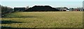
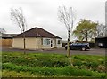
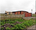
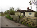
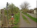
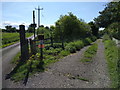
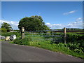
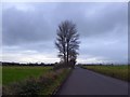
Photos of BA16 9WB
Area Information
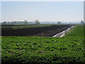
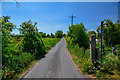
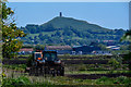
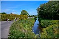
BA16 9WB is a small residential cluster in Somerset, England, nestled near the River Brue and the Somerset Levels. The area is part of the village of Sharpham, a historic parish with roots tracing back to the 13th century. With a population of 1,277 and a density of 67 people per square kilometre, it retains a quiet, low-density character. The parish is close to Glastonbury, a town known for its spiritual and cultural significance, and benefits from proximity to the River Brue, which has shaped the local landscape for centuries. Daily life here is defined by its rural setting, with agriculture and organic food production central to the local economy. Sharpham Park, a Grade II* listed estate, is a key landmark, operated as an organic farm and heritage site. The area’s charm lies in its blend of historical depth and modern simplicity, with a focus on sustainability and traditional land use. For those seeking a peaceful, low-traffic environment with easy access to nearby towns, BA16 9WB offers a distinct blend of heritage and contemporary living.
- Area Type
- Postcode
- Area Size
- Not available
- Population
- 1277
- Population Density
- 67 people/km²
The property market in BA16 9WB is characterised by a high rate of home ownership (82%) and a predominance of houses as the primary accommodation type. This suggests a market skewed towards owner-occupied properties rather than rental units, reflecting the area’s rural, low-density nature. The absence of flats or apartments indicates that housing stock is largely traditional, with a focus on detached or semi-detached homes. For buyers, this means a limited but stable market, with properties likely to be long-term investments rather than short-term rental opportunities. The small size of the postcode area and its proximity to Glastonbury may mean that buyers should consider nearby towns for additional options. The emphasis on houses also implies that properties here are likely to be spacious, with larger gardens, appealing to those seeking a quieter, more private lifestyle. However, the limited scale of the area means that the housing stock is not extensive, requiring careful consideration of location and availability.
House Prices in BA16 9WB
No properties found in this postcode.
Energy Efficiency in BA16 9WB
The lifestyle in BA16 9WB is shaped by its rural setting and proximity to agricultural and historical sites. Nearby amenities include retail outlets such as Aldi, Tesco, and Morrisons in Glastonbury, which are within practical reach for residents. The area’s economy is rooted in agriculture, with Sharpham Park operating as an organic farm producing spelt-based products and rare-breed livestock. This focus on sustainable farming adds a unique character to the local environment, with opportunities for visitors to engage with agricultural practices. The nearby Sharpham Moor Plot, a Site of Special Scientific Interest, offers recreational and educational value, with botanical records dating back to 1915. The area’s historical significance, including its Bronze Age trackway and medieval estate, provides a rich backdrop for those interested in heritage and archaeology. While the immediate postcode has limited retail options, the nearby towns of Glastonbury and Street offer a broader range of shops, dining, and services, ensuring that residents have access to essential amenities without needing to travel far.
Amenities
Schools
The nearest school to BA16 9WB is the Walton Church of England Voluntary Controlled Primary School, which serves the local community with a good Ofsted rating. This primary school is the only educational institution listed in the data, indicating that families in the area may need to look beyond the immediate postcode for secondary education options. The presence of a well-rated primary school is a significant draw for families with young children, offering a stable and reputable foundation for early education. However, the absence of secondary schools within the area means that students will need to travel to nearby towns such as Glastonbury or Street for further schooling. This could be a practical consideration for parents evaluating the long-term needs of their family. The school’s status as a voluntary controlled institution suggests it may have a strong community focus, with potential links to local churches or organisations.
| Rank | School | Type | Entry gender | Ages |
|---|
Explore more schools in this area
Go to Schools tabDemographics
The population of BA16 9WB has a median age of 47, with the majority of residents falling within the 30–64 age range. This suggests a mature, stable community with a strong presence of middle-aged adults. Home ownership is high at 82%, indicating a predominantly owner-occupied area with long-term residents. The accommodation type is primarily houses, reflecting a preference for detached or semi-detached properties over flats. The predominant ethnic group is White, with no specific data provided on other demographics. The low population density of 67 people per square kilometre reinforces the area’s rural, spread-out nature. While no explicit deprivation data is available, the high home ownership and age profile suggest a community with established roots and limited reliance on social housing. This demographic profile aligns with a lifestyle prioritising privacy, property investment, and a connection to the surrounding natural environment.
Household Size
Accommodation Type
Tenure
Ethnic Group
Religion
Household Composition
Age
Household Deprivation
NS-SEC
Explore more demographic insights in this area
Go to Demographics tabPlanning
Planning Constraints
- Flood RiskPremium
- Ramsar Wetland SitesPremium
- Area of Outstanding Natural BeautyPremium
- Protected Nature ReservePremium
- Protected WoodlandPremium