Area Overview for BA16 9RT
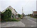
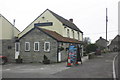
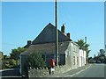
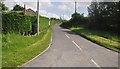
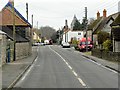
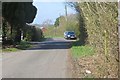
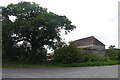
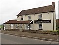
Photos of BA16 9RT
Area Information
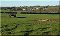
Living in BA16 9RT offers a quiet residential experience within a specific postcode cluster just 1,543 square metres in extent. This small area is home to 1,277 people, creating a tightly knit community where neighbours are likely to know one another. The low population density of 67 people per square kilometre ensures a peaceful environment, free from the congestion found in more densely packed urban zones. Residents enjoy a setting that prioritises space and tranquility, making it an attractive option for those seeking to escape the bustle of larger towns. The dominance of houses over apartments shapes the built environment, providing generous living spaces and private gardens for most households. Families and individuals find stability here, with a strong focus on home ownership rather than transient renting. Daily life revolves around the immediate neighbourhood, where the lack of major planning constraints means development is unlikely to disrupt the established character of the street. You are looking at a straightforward living situation where the focus remains on the home itself rather than complex shared facilities found in high-density developments. The area presents a clear picture of traditional suburban living, bounded by practical considerations and a distinct sense of locality.
- Area Type
- Postcode
- Area Size
- 1543 m²
- Population
- 1277
- Population Density
- 67 people/km²
The property market in BA16 9RT is characterised by a scarcity of rental stock and a overwhelming preference for ownership. With 82% of homes owned outright, this is not a commuter belt for temporary workers or students seeking short-term accommodation. The vast majority of properties listed as accommodation type are houses, meaning you will not find apartments or purpose-built flats in this specific postcode. This suggests that new-build development or conversion to flats is unlikely to change the fabric of BA16 9RT soon. Buyers looking here should expect to compete with other owner-occupiers who take a long-term view of their investment. The low total area of 1,543 square metres limits the number of new listings that will ever appear, making any available house a rare opportunity. You are looking at a market driven by maintenance costs rather than rental yield potential, as few landlords operate in this cluster. The prevalence of houses also implies that buying involves significant responsibility for repairs and upkeep, a factor reflected in the high ownership rate. For those considering homes in BA16 9RT, the lack of rental options means you must be prepared to stay for the long term. The market is stable because almost everyone who moves in intends to live there for years, removing the volatility often seen in areas reliant on external tenant flows.
House Prices in BA16 9RT
Showing 7 properties
| Address | Type | Beds | Baths | Last Sale Price | Last Sale Date | |
|---|---|---|---|---|---|---|
| 4 Teign Court, Walton, Street, BA16 9RT | Terraced | 2 | - | £152,500 | Sep 2015 | |
| 5 Teign Court, Walton, Street, BA16 9RT | house | - | - | £148,000 | Sep 2012 | |
| 6 Teign Court, Walton, Street, BA16 9RT | house | - | - | £125,000 | May 2010 | |
| 3 Teign Court, Walton, Street, BA16 9RT | house | - | - | £81,000 | Dec 2001 | |
| 2 Teign Court, Walton, Street, BA16 9RT | Terraced | - | - | £42,000 | Nov 1996 | |
| 7 Teign Court, Walton, Street, BA16 9RT | house | 2 | 1 | - | - | |
| 1 Teign Court, Walton, Street, BA16 9RT | Terraced | - | - | - | - |
Energy Efficiency in BA16 9RT
Daily life in BA16 9RT features practical convenience through accessible retail amenities within a short distance. You have five retail options in your immediate vicinity, including Lidl Street, Iceland Street, and Sainsburys Street. These specific locations provide for most everyday shopping needs, from fresh groceries to household essentials, without requiring a long drive. The presence of these named outlets demonstrates that your routine errands can be completed locally, saving time and reducing reliance on major town centres. Beyond basic shopping, the character of the area is defined by its residential focus, with houses dominating the landscape rather than high-density blocks. This layout supports a slower pace of life where the nearest shops are part of the morning or evening routine rather than a bustling commercial hub. The area lacks the complex leisure facilities found in city centres, meaning entertainment likely involves local parks or trips to nearby towns. However, the reliability of having supermarkets like Lidl and Sainsburys ensures that quality of life remains high regarding daily necessities. Living in BA16 9RT means you have your essentials right on your doorstep, fostering a self-sufficient lifestyle where you do not need to travel far for the basics. The amenities listed are strictly functional, catering to the practical needs of a homeownership-heavy community rather than luxury retail or nightlife.
Amenities
Schools
Families in BA16 9RT have access to Walton Church of England Voluntary Controlled Primary School, which serves the immediate neighbourhood. This institution holds an Ofsted rating of good, placing it above average in the national framework for evaluating educational quality. As a primary school, it caters to young children, meaning BA16 9RT is well-suited for those with younger family members. The fact that this is the only school listed for this specific postcode indicates that older children and teenagers likely travel to schools beyond the immediate vicinity or attend secondary institutions not detailed in this data. A good Ofsted rating suggests standards are high, providing peace of mind for parents choosing schools near BA16 9RT for their children. The single primary option available within the data set means local catchment arrangements are straightforward for early education. You should verify the catchment area if you plan to move here with young children, as residence within BA16 9RT currently links you to this specific educational provider. The presence of a voluntary controlled school implies a specific governance structure that local families are accustomed to. This educational provision forms the backbone of the area's appeal to family buyers, ensuring that the decision to live here supports your child's schooling needs from an early age.
| Rank | School | Type | Entry gender | Ages |
|---|
Explore more schools in this area
Go to Schools tabDemographics
The community in BA16 9RT is defined by a mature population with a median age of 47 years. Most residents fall into the adult age range of 30 to 64 years, indicating a neighbourhood dominated by established families or professionals further along in their careers. This age profile suggests a stable demographic with deep roots in the locality. Home ownership stands at 82%, which is exceptionally high for this region. This figure confirms that the vast majority of residents live in their own homes rather than renting. The accommodation type is exclusively houses, aligning with the high ownership rate and age profile. There is no data provided for ethnic diversity percentages, but the predominant ethnic group is recorded as White. The area does not show the high levels of recent migration or student population often found in university towns. Instead, the social fabric is woven from long-term residents. This stability contributes to a predictable environment where community bonds are typically strong. You will encounter a neighbourhood where generations have remained, fostering a sense of continuity that is rare in rapidly changing areas. The lack of a significant youth population outside the 30-64 bracket shapes the local culture, affecting everything from shop openings to community events.
Household Size
Accommodation Type
Tenure
Ethnic Group
Religion
Household Composition
Age
Household Deprivation
NS-SEC
Explore more demographic insights in this area
Go to Demographics tabPlanning
Planning Constraints
- Flood RiskPremium
- Ramsar Wetland SitesPremium
- Area of Outstanding Natural BeautyPremium
- Protected Nature ReservePremium
- Protected WoodlandPremium