Area Overview for BA16 0WB
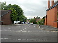
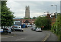
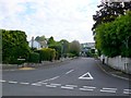
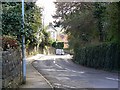
Photos of BA16 0WB
Area Information
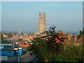
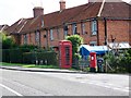
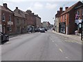
Living in BA16 0WB means inhabiting a small, tightly knit residential cluster in England’s Somerset Levels. With a population of 2,673 and a density of 893 people per square kilometre, this area balances compact living with a rural character. The postcode lies near Glastonbury, a town steeped in history and myth, known for its connection to Arthurian legends and the iconic Glastonbury Tor. Daily life here is shaped by its proximity to both natural and cultural landmarks, with the Somerset Levels’ low-lying landscape offering a unique backdrop. The area’s small size means a strong sense of community, though its limited housing stock suggests a focus on long-term residents rather than transient populations. For those seeking a quiet, historic setting with easy access to amenities, BA16 0WB combines practicality with a touch of the mystical.
- Area Type
- Postcode
- Area Size
- Not available
- Population
- 2673
- Population Density
- 893 people/km²
The property market in BA16 0WB is characterised by a high rate of home ownership (69%) and a focus on houses rather than flats or apartments. This suggests a market skewed towards owner-occupied properties, likely attracting families or individuals seeking permanent residences. The small area’s limited housing stock means the market is not expansive, and buyers may need to consider nearby regions for more options. The prevalence of houses implies a demand for space, possibly influenced by the area’s rural setting and proximity to natural features like the Somerset Levels. For buyers, this means a niche market with fewer properties available, but one that may offer a sense of exclusivity or long-term investment potential in a historically significant region.
House Prices in BA16 0WB
No properties found in this postcode.
Energy Efficiency in BA16 0WB
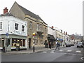
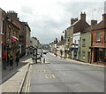
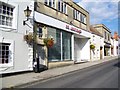
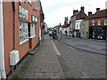
The lifestyle in BA16 0WB is shaped by its proximity to retail and community hubs. Within practical reach are five retail venues, including The Radstock Co-operative Society, Morrisons Glastonbury, and Tesco Glastonbury, ensuring access to essential shopping and services. While the area lacks detailed data on dining or leisure facilities, its connection to Glastonbury’s historic sites—such as the Glastonbury Tor and the ruins of Glastonbury Abbey—adds cultural and recreational value. The Somerset Levels’ low-lying landscape, though historically prone to flooding, now supports agriculture and offers scenic walks. This blend of practical amenities and historic allure creates a lifestyle that balances convenience with a touch of rural mystique.
Amenities
Schools
Residents of BA16 0WB have access to two schools: St Dunstan’s Community School, a primary institution, and St Dunstan’s School, an academy with a ‘good’ Ofsted rating. The presence of both primary and academy schools provides families with a range of educational options, from early years through to secondary education. The academy’s positive rating indicates a standard of teaching and facilities that meets or exceeds national benchmarks. For parents, this mix ensures continuity in a child’s education while offering the structure of a maintained school alongside the autonomy of an academy. The proximity of these institutions to the area reinforces its appeal as a family-friendly location, particularly for those prioritising quality schooling in a rural context.
| Rank | School | Type | Entry gender | Ages |
|---|---|---|---|---|
| 1 | St Dunstan's Community School | primary | N/A | N/A |
| 2 | St Dunstan's School | academy | N/A | N/A |
Explore more schools in this area
Go to Schools tabDemographics
The community in BA16 0WB is predominantly composed of adults aged 30–64, with a median age of 47. This suggests a mature, stable population, likely with established careers and family ties. Home ownership is high at 69%, indicating a strong preference for long-term residency over rental properties. The accommodation type is primarily houses, which aligns with the area’s residential cluster profile and may cater to families or individuals seeking space. The predominant ethnic group is White, reflecting broader trends in rural England. While no specific data on deprivation is provided, the high home ownership and age profile suggest a community with relatively stable economic conditions, though the small population size may limit diversity in local services or social dynamics.
Household Size
Accommodation Type
Tenure
Ethnic Group
Religion
Household Composition
Age
Household Deprivation
NS-SEC
Explore more demographic insights in this area
Go to Demographics tabPlanning
Planning Constraints
- Flood RiskPremium
- Ramsar Wetland SitesPremium
- Area of Outstanding Natural BeautyPremium
- Protected Nature ReservePremium
- Protected WoodlandPremium
- Crime RiskPremium