Area Overview for BA16 0WA
Photos of BA16 0WA
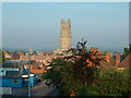
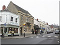
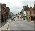
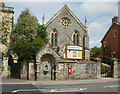
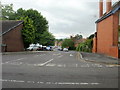
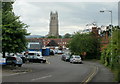
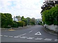
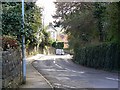
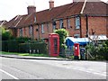
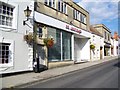
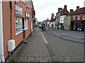
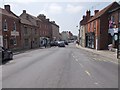
Area Information
Living in BA16 0WA means inhabiting a small, tightly knit residential cluster in Somerset, where the population of 2,673 people is spread across a compact area with a density of 893 people per square kilometre. This postcode sits within the historic town of Glastonbury, a place steeped in legend and natural beauty. The area’s character is shaped by its proximity to the Somerset Levels, a low-lying landscape once prone to flooding but now largely drained for agriculture. Glastonbury itself is a town of mystique, with landmarks like the Glastonbury Tor and the ruins of Glastonbury Abbey drawing visitors and residents alike. Daily life here balances rural tranquillity with access to nearby amenities, while the community benefits from a strong sense of local identity. The area’s small size means it is easy to navigate, and its historical roots add a layer of cultural richness. Whether you are drawn to the town’s ancient heritage or its modern practicalities, BA16 0WA offers a distinct blend of history and contemporary living.
- Area Type
- Postcode
- Area Size
- Not available
- Population
- 2673
- Population Density
- 893 people/km²
The property market in BA16 0WA is characterised by a high rate of home ownership, with 69% of properties owned by their occupants. This suggests a strong preference for long-term residency over rental living, which is typical of smaller, rural communities. The predominant accommodation type is houses, indicating that the area is not dominated by flats or apartments. This makes BA16 0WA an attractive option for buyers seeking traditional, spacious homes in a low-density setting. Given the small size of the postcode area, properties are likely to be closely spaced, with limited scope for large developments. For those considering the area, the focus on owner-occupied housing means competition for available properties could be keen, particularly for homes that align with the local architectural style. Buyers should also consider the proximity to amenities and the area’s historical significance when evaluating property value and suitability.
House Prices in BA16 0WA
No properties found in this postcode.
Energy Efficiency in BA16 0WA
The lifestyle in BA16 0WA is supported by a range of nearby amenities, including five retail outlets such as The Radstock Co-operative Society, Morrisons Glastonbury, and Tesco Glastonbury. These stores provide essential shopping options, from groceries to general retail, ensuring that daily needs are easily met. The presence of these venues contributes to a convenient and self-sufficient local environment, reducing the need for long commutes to larger centres. The area’s proximity to Glastonbury also opens up access to cultural and historical sites, such as the Glastonbury Tor and the abbey ruins. While the immediate surroundings may lack large-scale leisure facilities, the nearby town offers a broader array of activities. For residents, the combination of practical amenities and the town’s unique character creates a lifestyle that blends rural simplicity with accessible modern comforts.
Amenities
Schools
The schools near BA16 0WA include St Dunstan’s Community School, a primary school serving local families, and St Dunstan’s School, an academy with a good Ofsted rating. These institutions provide a range of educational options, from early years to secondary education, ensuring that children have access to both state and academically focused schooling. The presence of an academy with a good rating suggests a commitment to quality education, which is a key consideration for families. The dual presence of a primary school and a larger academy supports a seamless transition through the education system. For parents, this mix of school types offers flexibility, whether they prioritise a community-focused primary school or a more academically rigorous secondary option. The proximity of these schools to the area reinforces its appeal as a family-friendly location.
| Rank | School | Type | Entry gender | Ages |
|---|
Explore more schools in this area
Go to Schools tabDemographics
The population of BA16 0WA is predominantly composed of adults aged 30 to 64, with a median age of 47. This suggests a mature, settled community, many of whom are likely to be long-term residents. Home ownership is high, with 69% of properties occupied by their owners, indicating a stable housing market. The accommodation types here are primarily houses, reflecting a preference for detached or semi-detached homes. The predominant ethnic group is White, which aligns with broader demographic trends in the region. The absence of specific data on deprivation means no direct conclusions can be drawn about economic challenges, but the high home ownership rate and age profile suggest a relatively affluent and stable demographic. For families or professionals seeking a settled environment, this area offers a mix of established households and a low turnover of residents.
Household Size
Accommodation Type
Tenure
Ethnic Group
Religion
Household Composition
Age
Household Deprivation
NS-SEC
Explore more demographic insights in this area
Go to Demographics tabPlanning
Planning Constraints
- Flood RiskPremium
- Ramsar Wetland SitesPremium
- Area of Outstanding Natural BeautyPremium
- Protected Nature ReservePremium
- Protected WoodlandPremium