Area Overview for BA16 0EX
Photos of BA16 0EX
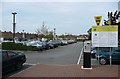
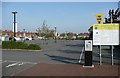
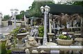
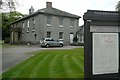
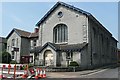
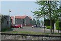
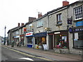
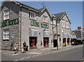
100 photos from this area
Area Information
Key information about the BA16 0EX including its size, population, and administrative classification.
- Area Type
- Postcode
- Area Size
- 5445 m²
- Population
- Not available
- Population Density
- Not available
House Prices in BA16 0EX
10
Properties
£585,000
Average Sold Price
£585,000
Lowest Price
£585,000
Highest Price
Showing 10 properties
| Address | Type | Beds | Baths | Last Sale Price | Last Sale Date | |
|---|---|---|---|---|---|---|
| 149 High Street, Street, BA16 0EX | Detached | 4 | 2 | £585,000 | Oct 2023 | |
| Dali Chiro Ltd, 141C High Street, Street, BA16 0EX | retail_financial | - | - | - | - | |
| 141 High Street, Street, BA16 0EX | Office | - | - | - | - | |
| Woodward Ins And Mortgageservices Ltd, Shop, 143 High Street, Street, BA16 0EX | shop | - | - | - | - | |
| Triangle Snooker Club, The Bayliss Centre, 147 High Street, Street, BA16 0EX | assembly_leisure | - | - | - | - | |
| First Floor Flat, 133 High Street, Street, BA16 0EX | Flat | - | - | - | - | |
| Westhay Opportunity Centre Ltd, First Floor Office, 145 High Street, Street, BA16 0EX | Office | - | - | - | - | |
| Flat, 137 High Street, Street, BA16 0EX | Flat | - | - | - | - | |
| 135A High Street, Street, BA16 0EX | Flat | - | - | - | - | |
| Flat, 145 High Street, Street, BA16 0EX | retail_financial | - | - | - | - |
Energy Efficiency in BA16 0EX
Amenities
Schools
| Rank | School | Type | Entry gender | Ages |
|---|
Explore more schools in this area
Go to Schools tabDemographics
Household Size
One person
most common
Accommodation Type
Houses
most common
Tenure
62
majority
Ethnic Group
White
most common
Religion
N/A
most common
Household Composition
N/A
most common
Age
47
median
Adults (30-64 years)
most common
Household Deprivation
N/A
with no deprivation
NS-SEC
32
in Lower managerial occupations
Explore more demographic insights in this area
Go to Demographics tabPlanning
Planning Constraints
- Flood RiskPremium
- Ramsar Wetland SitesPremium
- Area of Outstanding Natural BeautyPremium
- Protected Nature ReservePremium
- Protected WoodlandPremium