Area Overview for BA15 2YZ
Photos of BA15 2YZ
Area Information
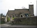
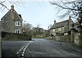
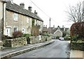
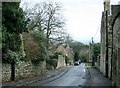
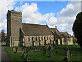
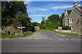
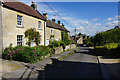
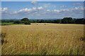
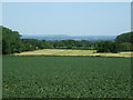
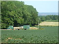
BA15 2YZ is a small postcode area in west Wiltshire, encompassing parts of Monkton Farleigh, a village with a population of 1,861 and a low density of 78 people per square kilometre. Situated 3 miles northwest of Bradford-on-Avon and near Bath, this area is defined by its historical Bath Stone mines, once converted into a Ministry of Defence ammunition depot. The village includes hamlets like Farleigh Wick and Pinckney Green, with remnants of a 12th-century priory and a parish church rebuilt in 1844. Daily life here is shaped by its rural setting, with a community rooted in local heritage. The area’s compact size means residents often live close to amenities, while its proximity to major towns offers access to broader services. With a median age of 47 and a population skewed toward adults aged 30–64, the area reflects a stable, mature demographic. Its low crime rate and absence of environmental constraints make it an appealing choice for those seeking a quiet, secure lifestyle with historical character.
- Area Type
- Postcode
- Area Size
- Not available
- Population
- 1861
- Population Density
- 78 people/km²
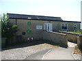
BA15 2YZ is predominantly an owner-occupied area, with 81% of homes owned by residents rather than rented. The accommodation type is primarily houses, indicating a focus on single-family dwellings rather than apartments or flats. This suggests a market tailored to families or individuals seeking spacious, private homes. Given the area’s small size and low population density, the housing stock is likely limited, meaning buyers may need to consider nearby towns for more options. The high home ownership rate and emphasis on houses reflect a community that values stability and property as an asset. For buyers, this means competition for available properties could be fierce, and the area may appeal to those seeking a rural lifestyle with historical character.
House Prices in BA15 2YZ
No properties found in this postcode.
Energy Efficiency in BA15 2YZ
Residents of BA15 2YZ have access to five retail venues, including Spar Bathampton, Co-op University of, and Budgens Ashley, offering convenience for daily shopping. The nearby rail stations provide links to broader networks, while the area’s rural character suggests limited large-scale leisure facilities. The presence of multiple retail outlets and transport options indicates a practical, community-focused lifestyle. However, the lack of detailed data on parks or recreational spaces means the extent of outdoor amenities remains unclear. Overall, the area balances local convenience with proximity to regional services, supporting a lifestyle that prioritises accessibility and historical context.
Amenities
Schools
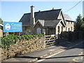
The nearest school to BA15 2YZ is Monkton Farleigh & South Wraxall Church of England Voluntary Controlled Primary School, a primary institution serving the local community. No secondary schools are listed in the data, so families may need to look beyond the immediate area for secondary education. The presence of a primary school suggests the area is suitable for families with younger children, though parents should consider proximity to secondary schools when planning long-term residency. The school’s voluntary controlled status indicates it may have a mix of state and church funding, potentially influencing its resources and curriculum.
| Rank | School | Type | Entry gender | Ages |
|---|
Explore more schools in this area
Go to Schools tabDemographics
The population of BA15 2YZ is 1,861, with a density of 78 people per square kilometre, indicating a sparse, low-rise residential cluster. The median age is 47, and the majority of residents are adults aged 30–64, suggesting a community with established careers and families. Home ownership is high at 81%, with houses the predominant accommodation type, reflecting a stable, long-term demographic. The predominant ethnic group is White, with no specific data on other groups provided. This age profile and ownership rate imply a mature, settled population less likely to move frequently. The area’s low population density and focus on owner-occupied homes suggest a quiet, community-oriented environment, where residents may prioritise property as a long-term investment.
Household Size
Accommodation Type
Tenure
Ethnic Group
Religion
Household Composition
Age
Household Deprivation
NS-SEC
Explore more demographic insights in this area
Go to Demographics tabPlanning
Planning Constraints
- Flood RiskPremium
- Ramsar Wetland SitesPremium
- Area of Outstanding Natural BeautyPremium
- Protected Nature ReservePremium
- Protected WoodlandPremium