Area Overview for BA15 2YT
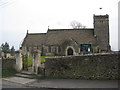
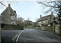
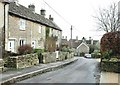
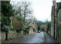
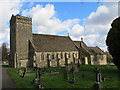
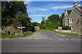
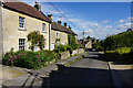
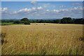
Photos of BA15 2YT
Area Information
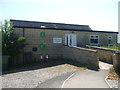
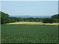
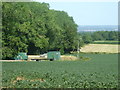
Living in BA15 2YT means being part of a small, tightly knit residential cluster in west Wiltshire, England. The postcode covers a village with a population of 1,861 people, spread over a low-density area of 78 people per square kilometre. This is a place where history meets quiet living, with Monkton Farleigh’s past as a site of Bath Stone mining and a former Cluniac priory shaping its character. The village lies 3 miles northwest of Bradford-on-Avon and within easy reach of Bath, offering a balance of rural tranquillity and proximity to larger towns. Daily life here is defined by a slower pace, with local amenities and community ties forming the backbone of the area. The presence of nearby rail stations and a primary school suggests a practical approach to living, catering to both local needs and connections to wider networks. For those seeking a home with historical context and a low population density, BA15 2YT offers a distinct alternative to urban living.
- Area Type
- Postcode
- Area Size
- Not available
- Population
- 1861
- Population Density
- 78 people/km²
The property market in BA15 2YT is characterised by a high rate of home ownership, with 81% of residents living in owner-occupied homes. The area is primarily composed of houses, reflecting a traditional, residential landscape rather than a mix of flats or apartments. This suggests a market that caters to families and individuals seeking stable, long-term housing rather than short-term rental opportunities. Given the small size of the area and the prevalence of houses, property availability is likely limited, making it a niche market for buyers seeking specific characteristics. Those considering the area should also look to nearby postcode clusters for additional options, as the immediate surroundings may offer more variety. The focus on owner-occupied homes indicates a community with strong ties to the area, though the limited housing stock means competition for available properties could be keen.
House Prices in BA15 2YT
No properties found in this postcode.
Energy Efficiency in BA15 2YT
The lifestyle in BA15 2YT is shaped by its proximity to small retail outlets and rail connections. Local shops include Spar Bathampton, Co-op University of, and Budgens Ashley, providing basic grocery and convenience services. These venues cater to everyday needs, though the selection is limited compared to larger towns. The area’s rail stations—Bradford, Freshford, and Avoncliff—offer access to wider networks, facilitating travel for work, shopping, or leisure. While the village itself lacks large-scale amenities, the surrounding region includes historical sites and natural landscapes, such as the remnants of the Cluniac Priory of St Mary Magdalene. The combination of practical retail options and accessible transport creates a lifestyle that balances local convenience with regional connectivity. For residents, this means a mix of self-sufficiency and the ability to engage with nearby towns for more extensive services.
Amenities
Schools
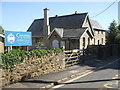
The nearest school to BA15 2YT is Monkton Farleigh & South Wraxall Church of England Voluntary Controlled Primary School, which serves the local community with primary education. The school’s status as a voluntary controlled primary indicates a mix of state funding and church involvement, though its Ofsted rating is not specified in the data. The absence of secondary schools in the immediate area means families may need to consider commuting to nearby towns like Bradford-on-Avon or Bath for secondary education. This primary school is the only educational institution listed, highlighting the limited local provision for children’s schooling. For families prioritising proximity to schools, the availability of a primary school is a positive, but the lack of secondary options may require planning for longer-term educational needs.
| Rank | School | Type | Entry gender | Ages |
|---|
Explore more schools in this area
Go to Schools tabDemographics
The community in BA15 2YT is predominantly middle-aged, with a median age of 47 and the majority of residents falling within the 30–64 age range. Home ownership is high, with 81% of households owning their homes, indicating a stable, long-term resident base. The area is largely composed of houses, reflecting a traditional, family-oriented housing stock. The predominant ethnic group is White, though specific data on diversity is not provided. With a population of 1,861, the area is small enough to foster familiarity among residents but not so densely populated as to feel overcrowded. The low population density of 78 people per square kilometre suggests spacious living conditions, though this also means services and amenities are limited to what is immediately available. The age profile and ownership rates suggest a community focused on settled living, with fewer transient populations.
Household Size
Accommodation Type
Tenure
Ethnic Group
Religion
Household Composition
Age
Household Deprivation
NS-SEC
Explore more demographic insights in this area
Go to Demographics tabPlanning
Planning Constraints
- Flood RiskPremium
- Ramsar Wetland SitesPremium
- Area of Outstanding Natural BeautyPremium
- Protected Nature ReservePremium
- Protected WoodlandPremium