Area Overview for BA15 2RW
Photos of BA15 2RW
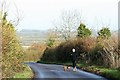
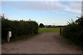
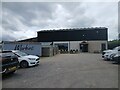
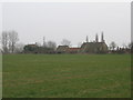
11 photos from this area
Area Information
Key information about the BA15 2RW including its size, population, and administrative classification.
- Area Type
- Postcode
- Area Size
- 79.2 hectares
- Population
- 1861
- Population Density
- 78 people/km²
House Prices in BA15 2RW
26
Properties
£448,556
Average Sold Price
£130,000
Lowest Price
£735,000
Highest Price
Showing 26 properties
| Address | Type | Beds | Baths | Last Sale Price | Last Sale Date | |
|---|---|---|---|---|---|---|
| 95 Bradford Leigh, Bradford Leigh, BA15 2RW | Cottage | 2 | 1 | £287,500 | Jul 2024 | |
| 101 Bradford Leigh, Bradford Leigh, BA15 2RW | house | - | - | £650,000 | Jan 2021 | |
| 102 Bradford Leigh, Bradford Leigh, BA15 2RW | Detached | - | - | £465,000 | Sep 2020 | |
| 105 Bradford Leigh, Bradford Leigh, BA15 2RW | Bungalow | - | - | £407,000 | Jun 2017 | |
| 93 Bradford Leigh, Bradford Leigh, BA15 2RW | Detached | 6 | - | £695,000 | Apr 2015 | |
| Blackacre Cottage, 38-40 Bradford Leigh, Bradford Leigh, BA15 2RW | Detached | 4 | - | £735,000 | Dec 2014 | |
| 107 Bradford Leigh, Bradford Leigh, BA15 2RW | Bungalow | 3 | - | £317,500 | Nov 2013 | |
| 98 Bradford Leigh, Bradford Leigh, BA15 2RW | house | - | - | £350,000 | Apr 2004 | |
| Rose Cottage, 97 Bradford Leigh, Bradford Leigh, BA15 2RW | Detached | 3 | - | £130,000 | Jan 2000 | |
| 94 Bradford Leigh, Bradford Leigh, BA15 2RW | Terraced | 4 | 2 | - | - |
Page 1 of 3
Energy Efficiency in BA15 2RW
Amenities
Schools
| Rank | School | Type | Entry gender | Ages |
|---|
Explore more schools in this area
Go to Schools tabDemographics
Household Size
Two person
most common
Accommodation Type
Houses
most common
Tenure
81
majority
Ethnic Group
White
most common
Religion
N/A
most common
Household Composition
N/A
most common
Age
47
median
Adults (30-64 years)
most common
Household Deprivation
N/A
with no deprivation
NS-SEC
51
in Lower managerial occupations
Explore more demographic insights in this area
Go to Demographics tabPlanning
Planning Constraints
- Flood RiskPremium
- Ramsar Wetland SitesPremium
- Area of Outstanding Natural BeautyPremium
- Protected Nature ReservePremium
- Protected WoodlandPremium