Area Overview for BA15 2JF
Photos of BA15 2JF
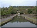
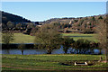
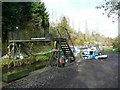
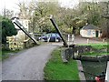
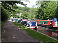
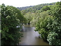
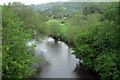
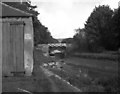
100 photos from this area
Area Information
Key information about the BA15 2JF including its size, population, and administrative classification.
- Area Type
- Postcode
- Area Size
- 89.0 hectares
- Population
- 1604
- Population Density
- 321 people/km²
House Prices in BA15 2JF
12
Properties
£476,667
Average Sold Price
£235,000
Lowest Price
£770,000
Highest Price
Showing 12 properties
| Address | Type | Beds | Baths | Last Sale Price | Last Sale Date | |
|---|---|---|---|---|---|---|
| 207 Conkwell, Winsley, BA15 2JF | Detached | 3 | 2 | £425,000 | Mar 2016 | |
| Dundas Barn, 214A Lane From County Boundary South To Conkwell Farm, Conkwell, Winsley, BA15 2JF | Detached | - | - | £770,000 | Sep 2005 | |
| 209 Conkwell, Winsley, BA15 2JF | Detached | - | - | £235,000 | Apr 2001 | |
| The Old Tea Gardens, 206 Conkwell, Winsley, BA15 2JF | house | 3 | 2 | - | - | |
| Spring Cottage, 205 Conkwell, Winsley, BA15 2JF | Detached | 4 | - | - | - | |
| Conkwell Lodge, Conkwell, Winsley, BA15 2JF | Detached | 4 | 1 | - | - | |
| Nightingale Cottage, 211 Conkwell, Winsley, BA15 2JF | house | 5 | - | - | - | |
| Penrose Cottage, 213 Conkwell, Winsley, BA15 2JF | Detached | - | - | - | - | |
| Myrtle Cottage, 208 Conkwell, Winsley, BA15 2JF | Detached | - | - | - | - | |
| Leyton Cottage, 214 Conkwell, Winsley, BA15 2JF | house | - | - | - | - |
Page 1 of 2
Energy Efficiency in BA15 2JF
Amenities
Schools
| Rank | School | Type | Entry gender | Ages |
|---|
Explore more schools in this area
Go to Schools tabDemographics
Household Size
Two person
most common
Accommodation Type
Houses
most common
Tenure
82
majority
Ethnic Group
White
most common
Religion
N/A
most common
Household Composition
N/A
most common
Age
47
median
Adults (30-64 years)
most common
Household Deprivation
N/A
with no deprivation
NS-SEC
53
in Lower managerial occupations
Explore more demographic insights in this area
Go to Demographics tabPlanning
Planning Constraints
- Flood RiskPremium
- Ramsar Wetland SitesPremium
- Area of Outstanding Natural BeautyPremium
- Protected Nature ReservePremium
- Protected WoodlandPremium