Area Overview for BA14 9YF
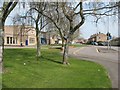
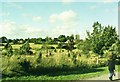
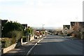
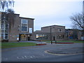
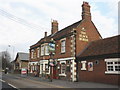
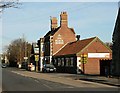
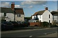
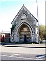
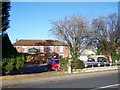
Photos of BA14 9YF

Area Information
Living in BA14 9YF means inhabiting a small, residential postcode area in Wiltshire, England, with a population of 1,948. This cluster of homes sits within the broader town of Trowbridge, a historic county town chosen in 1889 for its railway links. The area reflects a quiet, low-density lifestyle, with homes primarily occupied by owners rather than renters. The median age of 47 suggests a stable community, with many residents in their prime working years. Daily life here is shaped by proximity to Trowbridge’s heritage, including its 19th-century industrial past and modern administrative role as Wiltshire’s county town. The area’s small size means it is tightly knit, with local amenities and schools within walking or short driving distance. While the population is modest, the area benefits from strong digital connectivity and access to nearby rail services, making it a practical choice for those seeking a balance between rural tranquillity and urban convenience.
- Area Type
- Postcode
- Area Size
- Not available
- Population
- 1948
- Population Density
- 6107 people/km²
The property market in BA14 9YF is defined by a 31% home ownership rate, suggesting that the majority of properties are rented rather than owner-occupied. The accommodation type is primarily houses, which is typical for smaller towns and rural clusters. This contrasts with urban areas where flats or apartments dominate. The small size of the postcode means the housing stock is limited, with few new developments likely to emerge. For buyers, this implies a niche market with established properties rather than speculative investment opportunities. The predominance of houses may appeal to families seeking space, though the low ownership rate could indicate limited availability for purchase. The area’s proximity to Trowbridge’s town centre and transport links may make it attractive for those prioritising location over large-scale property selection. Buyers should consider the limited inventory and focus on existing homes rather than future growth.
House Prices in BA14 9YF
No properties found in this postcode.
Energy Efficiency in BA14 9YF
The lifestyle in BA14 9YF is shaped by its proximity to Trowbridge’s town centre, where retail and transport hubs are concentrated. Nearby amenities include five retail outlets, such as Tesco Trowbridge and Aldi North, providing essential shopping options within walking or short driving distance. The rail network, with stations like Trowbridge Railway Station and Avoncliff Railway Station, offers access to regional connectivity, though specific journey details are not provided. The area’s historical roots as a centre for woollen cloth production and its 19th-century administrative role add cultural depth. Locals may enjoy the town’s public park, established in the 1880s, and its museums documenting Trowbridge’s heritage. The mix of retail, transport, and green spaces supports a practical, community-oriented lifestyle, though the limited number of amenities means residents may need to travel further for specialist services.
Amenities
Schools
The nearest schools to BA14 9YF include Studley Green Primary School, listed twice in the data. This suggests the area is served by a single primary school, which may be the primary educational hub for local children. The absence of secondary schools or other educational institutions in the immediate vicinity means families may need to travel to Trowbridge or nearby towns for secondary education. The presence of a primary school indicates a focus on early years education, though the lack of detailed Ofsted ratings or performance data means potential buyers cannot assess the quality of schooling directly. For families prioritising proximity to schools, Studley Green Primary School is the primary option, but additional research into secondary education options would be necessary. The single school in the area may influence community cohesion, with local parents likely to be familiar with the institution.
| Rank | School | Type | Entry gender | Ages |
|---|
Explore more schools in this area
Go to Schools tabDemographics
The community in BA14 9YF is predominantly composed of adults aged 30–64, with a median age of 47. This suggests a mature, stable population, likely with established careers and families. Home ownership rates are relatively low at 31%, indicating that a significant portion of the housing stock is rented. The area is characterised by houses rather than flats, reflecting a preference for single-family dwellings. The predominant ethnic group is White, with no specific data on other demographics. The age profile implies a community with a strong presence of middle-aged professionals and families, though the lack of data on younger or older residents means the full generational spectrum is unclear. The 31% ownership rate may influence local dynamics, with renters potentially forming a larger share of the population. This demographic profile aligns with a town-centre location, where housing is often mixed-use but not densely packed.
Household Size
Accommodation Type
Tenure
Ethnic Group
Religion
Household Composition
Age
Household Deprivation
NS-SEC
Explore more demographic insights in this area
Go to Demographics tabPlanning
Planning Constraints
- Flood RiskPremium
- Ramsar Wetland SitesPremium
- Area of Outstanding Natural BeautyPremium
- Protected Nature ReservePremium
- Protected WoodlandPremium