Area Overview for BA14 9SS
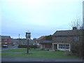
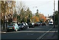
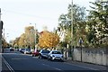
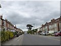
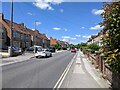
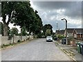
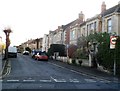
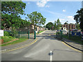
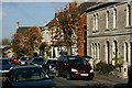
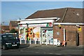
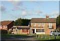
Photos of BA14 9SS

Area Information
Living in BA14 9SS places you within a compact residential cluster defined by a postcode area covering 9906 square metres. This small geographic footprint contains 1,618 residents, creating an intimate setting where neighbours are easily recognised. The location sits within Trowbridge, the county town of Wiltshire, which was selected for its administrative role in 1889 due to its historical railway connections. You reside in a district where the historic Trowbridge Anticline, a ridge of Cornbrash limestone, once dictated the drainage and settlement patterns of the broader town. Daily life here revolves around a population with a median age of 47, suggesting a mature, established community. The environment is distinctly residential, devoid of major commercial pressure within the postcode itself, yet closely linked to the rich heritage of the surrounding city. You enjoy a neighbourhood where the density is high relative to the land size, fostering a close-knit atmosphere typical of such concentrated postcodes in England. This area serves as a quiet node within the larger town, offering residents a sense of stability rooted in the long history of the Bristol Avon valley and the River Biss. Families and those seeking a settled, owner-occupied environment will find BA14 9SS to be a practical choice. The streets here are part of the fabric of a town that gained prominence during the 19th century as a centre for woollen cloth production. While the immediate area is residential, it is surrounded by the infrastructure and history that define Wiltshire's administrative heart. You are living in an area where the past meets the present, offering the convenience of a major town while maintaining the discreet, homely feel of a specific, bounded postcode sector.
- Area Type
- Postcode
- Area Size
- 9906 m²
- Population
- 1618
- Population Density
- 3173 people/km²
The property market in BA14 9SS is characterised overwhelmingly by owner-occupancy, with a home ownership rate of 83 per cent. This figure indicates that the vast majority of the 1,618 residents in this postcode have purchased their homes and remain in the property they own. The accommodation type data confirms that houses are the predominant housing form, meaning you will find mostly detached or semi-detached structures rather than purpose-built flats or apartments. This housing stock appeals to families and individuals seeking the permanence and privacy that comes with owning a standalone home. Given that this is a small residential cluster covering only 9906 square metres, the market is likely tight-knit, with properties reflecting the enduring nature of the local housing stock. The high proportion of homeowners suggests that the area attracts buyers looking for stability rather than investors seeking quick turnovers. Those considering buying a home in BA14 9SS can expect to enter a market where the majority of neighbours are settled residents. This environment often correlates with stronger community cohesion and lower levels of vacancy rates compared to more transient locations. The dominance of house ownership also means that rental demand is likely low within the specific bounds of the postcode. If you are looking to move here, you are entering a market where selling is competitive and prices are supported by local demand from residents who wish to stay. The lack of a significant rental sector suggests that the area is not a hotspot for short-stay holiday lets or corporate housing, further reinforcing its status as a genuine family and long-term living zone.
House Prices in BA14 9SS
Showing 22 properties
| Address | Type | Beds | Baths | Last Sale Price | Last Sale Date | |
|---|---|---|---|---|---|---|
| 14 Queens Club Gardens, Trowbridge, BA14 9SS | Terraced | 3 | 1 | £275,000 | May 2025 | |
| 16 Queens Club Gardens, Trowbridge, BA14 9SS | Semi-detached | 3 | 1 | £232,000 | Jun 2021 | |
| 33 Queens Club Gardens, Trowbridge, BA14 9SS | Semi-detached | 4 | 2 | £290,000 | Jun 2020 | |
| 31 Queens Club Gardens, Trowbridge, BA14 9SS | house | - | - | £209,995 | Sep 2018 | |
| 20 Queens Club Gardens, Trowbridge, BA14 9SS | Semi-detached | 5 | 3 | £285,000 | May 2018 | |
| 19 Queens Club Gardens, Trowbridge, BA14 9SS | Semi-detached | 3 | 1 | £204,000 | Mar 2017 | |
| 23 Queens Club Gardens, Trowbridge, BA14 9SS | house | - | - | £175,000 | Jun 2011 | |
| 36 Queens Club Gardens, Trowbridge, BA14 9SS | Terraced | 3 | 1 | £150,000 | Jun 2011 | |
| 34 Queens Club Gardens, Trowbridge, BA14 9SS | house | - | - | £136,500 | Mar 2010 | |
| 21 Queens Club Gardens, Trowbridge, BA14 9SS | Semi-detached | - | - | £182,000 | Sep 2007 |
Energy Efficiency in BA14 9SS
Living in BA14 9SS offers convenient access to the retail and transport hubs of Trowbridge, the county town. Within practical reach, you have five retail amenities to choose from, including Tesco Trowbridge, Asda Trowbridge, and Iceland Trowbridge. These supermarkets provide all the daily necessities required for home cooking and shopping, ensuring you never need to travel far for groceries or household goods. The availability of multiple major retailers indicates a competitive and well-stocked local high street. Beyond retail, the area benefits from excellent rail connectivity, with five nearby rail services including Trowbridge Railway Station, Bradford, and Avoncliff Railway Station. While the specific journey times are not detailed in the local data, the presence of these stations within the town ensures that accessing the wider national rail network is straightforward. You can utilise these services for commuting to London, Bristol, or Bath without needing to drive for most of your journeys. Your lifestyle in this postcode is supported by the central location of Trowbridge, which was established as the county town in 1889. The town has a rich history, now reflected in its well-maintained high street and easy access to services. You are living in a town with a museum documenting its history and County Hall, though these are located within the wider town rather than the specific cluster of BA14 9SS. The combination of local supermarkets and nearby train stations makes daily life efficient and enjoyable.
Amenities
Schools
Families considering living in BA14 9SS have one main educational option immediately within the reach of the postcode area. The John of Gaunt School serves the local community and is listed as both a primary school and an academy. This institution holds a Good rating from Ofsted, indicating a standard of education that meets government expectations for quality and provision. For residents prioritising education, the presence of an academy with a Good rating is a notable positive feature for the neighbourhood. While the data provided names only one specific institution, The John of Gaunt School, the arrangement offers a single-point reference for primary education within the immediate vicinity. This dual function, operating as both a primary and academy, suggests an integrated approach that may simplify navigation for parents. The school covers the early years of education, providing a local setting for children before they transition to secondary institutions further away. For prospective homebuyers, the proximity to The John of Gaunt School is a key factor in your decision-making. You do not have to travel far to access state-maintained education with a recognised standard of quality. The fact that it operates as an academy also means it has greater autonomy in how it delivers its curriculum and manages its budget compared to community schools. This structure often appeals to parents looking for a stable educational environment with a track record of positive outcomes, as evidenced by the GoodOfsted rating.
| Rank | School | Type | Entry gender | Ages |
|---|
Explore more schools in this area
Go to Schools tabDemographics
The community in BA14 9SS is defined by a mature demographic profile with a median age of 47 years. The most common age range among residents is adults between 30 and 64 years, indicating a population heavily weighted towards working-age professionals and retirees who have settled into the area. Eighty-three per cent of households own their homes, which signals a high level of stability and long-term commitment to the locality. This ownership rate places the area firmly in the category of an established, owner-occupied district rather than a transient or rental-heavy zone. Accommodation in this cluster is predominantly comprised of houses, reflecting a preference for detached or semi-detached living over flats or apartments. The ethnic composition is predominantly White, aligning with the broader demographic trends of the surrounding Wiltshire region. You are living in a neighbourhood where the social fabric is built around home ownership and family life, with a significant proportion of the 1,618 residents falling into the 30-64 age bracket. This age profile suggests a quiet, stable environment where daily routines are predictable and community ties are likely strong. The high percentage of homeownership implies that property values here have been stable and driven by long-term investment rather than speculative short-term lets. The population density of 163,332 people per square kilometre appears statistically extreme but represents the concentration within this very small 9906 square metre postal coverage. When viewed in the context of the wider town, BA14 9SS represents a densely populated residential unit where the majority of people are putting down roots. You will find a community that prioritises domestic privacy and security, with very few empty houses or rental properties disrupting the established character of the housing stock.
Household Size
Accommodation Type
Tenure
Ethnic Group
Religion
Household Composition
Age
Household Deprivation
NS-SEC
Explore more demographic insights in this area
Go to Demographics tabPlanning
Planning Constraints
- Flood RiskPremium
- Ramsar Wetland SitesPremium
- Area of Outstanding Natural BeautyPremium
- Protected Nature ReservePremium
- Protected WoodlandPremium