Area Overview for BA14 9LF
Photos of BA14 9LF
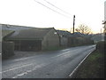
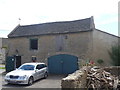
![Through the crop [1] in BA14 9LF](https://images.propbar.co.uk/images/geograph/58/82/5882512_120.jpg)
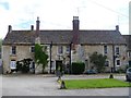
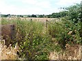
![Through the crop [2] in BA14 9LF](https://images.propbar.co.uk/images/geograph/58/82/5882516_120.jpg)
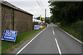
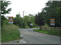
![The lane on the boundary [1] in BA14 9LF](https://images.propbar.co.uk/images/geograph/58/84/5884216_120.jpg)
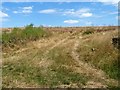
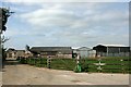
![Stowford Farm [1] in BA14 9LF](https://images.propbar.co.uk/images/geograph/58/82/5882527_120.jpg)
24 photos from this area
Area Information
Key information about the BA14 9LF including its size, population, and administrative classification.
- Area Type
- Postcode
- Area Size
- 43.6 hectares
- Population
- 2456
- Population Density
- 142 people/km²
House Prices in BA14 9LF
5
Properties
£676,625
Average Sold Price
£365,000
Lowest Price
£1,010,000
Highest Price
Showing 5 properties
| Address | Type | Beds | Baths | Last Sale Price | Last Sale Date | |
|---|---|---|---|---|---|---|
| 2, Wingfield House, Bradford Road, Wingfield, BA14 9LF | Detached | 7 | 4 | £1,010,000 | Apr 2018 | |
| 3, Wingfield House, Bradford Road, Wingfield, BA14 9LF | Detached | 4 | 3 | £766,500 | Aug 2017 | |
| 4, Wingfield House, Bradford Road, Wingfield, BA14 9LF | Bungalow | 2 | - | £565,000 | Oct 2012 | |
| 1, Wingfield House, Bradford Road, Wingfield, BA14 9LF | Semi-detached | 4 | 2 | £365,000 | Jan 1998 | |
| Old Bake House, 79 Bradford Road, Wingfield, BA14 9LF | house | - | - | - | - |
Energy Efficiency in BA14 9LF
Amenities
Schools
| Rank | School | Type | Entry gender | Ages |
|---|
Explore more schools in this area
Go to Schools tabDemographics
Household Size
Two person
most common
Accommodation Type
Houses
most common
Tenure
80
majority
Ethnic Group
White
most common
Religion
N/A
most common
Household Composition
N/A
most common
Age
47
median
Adults (30-64 years)
most common
Household Deprivation
N/A
with no deprivation
NS-SEC
34
in Lower managerial occupations
Explore more demographic insights in this area
Go to Demographics tabPlanning
Planning Constraints
- Flood RiskPremium
- Ramsar Wetland SitesPremium
- Area of Outstanding Natural BeautyPremium
- Protected Nature ReservePremium
- Protected WoodlandPremium