Area Overview for BA14 9JS
Photos of BA14 9JS


Area Information
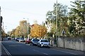
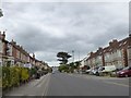
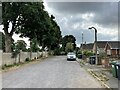
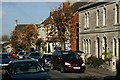
Living in BA14 9JS means being part of a small, tightly knit residential cluster in Trowbridge, Wiltshire. With a population of just 1,948, this postcode area offers a quiet, low-density lifestyle typical of rural England. Trowbridge itself has long been the administrative heart of Wiltshire, chosen in 1889 for its railway links that connected towns like Swindon and Salisbury. The area sits on the Trowbridge Anticline, a natural ridge of Cornbrash limestone, which contrasts with the surrounding claylands. Daily life here is shaped by the town’s historic character, including its medieval street layout and the remnants of its once-thriving woollen cloth industry. Proximity to the River Biss and the Kennet and Avon Canal adds to its geographical distinctiveness. While the area is small, it benefits from modern infrastructure, including excellent broadband connectivity and accessible rail links. For those seeking a balance between heritage and convenience, BA14 9JS offers a glimpse into a town that has retained its charm while adapting to contemporary needs.
- Area Type
- Postcode
- Area Size
- Not available
- Population
- 1948
- Population Density
- 6107 people/km²
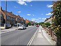
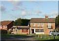
The property market in BA14 9JS is defined by its small size and limited housing stock. With only 31% of homes owned by residents, the area leans heavily towards rental properties, which may reflect its role as a commuter hub or a stopgap for those not yet ready to commit to homeownership. The accommodation type is predominantly houses, which is unusual for a small postcode area but may indicate a mix of older, larger properties. This suggests that the housing stock is not characterised by high-density flats or modern developments. For buyers, the limited number of available homes means competition can be fierce, especially for properties that meet the demand for family-sized homes. Those considering the area should also look beyond the immediate postcode, as the surrounding regions may offer more options. The low home ownership rate also hints at a potential opportunity for investors, though the small scale of the market means it is unlikely to be a high-volume area for property transactions.
House Prices in BA14 9JS
No properties found in this postcode.
Energy Efficiency in BA14 9JS
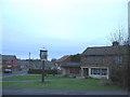
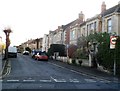
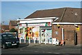
The lifestyle in BA14 9JS is shaped by its proximity to Trowbridge’s town centre, which includes the Castle Place Shopping Centre and a public park established in the 1880s. Retail options are varied, with five notable stores, including Tesco Trowbridge and Aldi North, providing everyday essentials. The railway stations, such as Trowbridge Railway Station, offer access to broader regional networks, enhancing the area’s connectivity. The historic character of Trowbridge, including its medieval street layout and restored timber-framed buildings, adds to the area’s appeal. The public park, once the grounds of Hall’s Place, offers green space for leisure and recreation. While dining options are not explicitly listed, the town’s historical role as a commercial hub suggests a range of local eateries and services. The combination of practical amenities and historical charm creates a balanced lifestyle for residents.
Amenities
Schools
The nearest schools to BA14 9JS are both Studley Green Primary School, a primary school that serves the local community. While the data lists the school twice, it is likely a single institution with dual entries. This suggests a focused provision for primary education, though the absence of secondary schools within the postcode means families may need to consider nearby towns for secondary education. The concentration of primary schooling is typical of smaller communities where local schools are the cornerstone of the educational landscape. For parents, this implies a reliance on the quality of Studley Green Primary School, though the lack of Ofsted ratings or performance data means its effectiveness cannot be assessed from the available information. The presence of a single primary school may also indicate a need for additional educational resources or transport arrangements for older children.
| Rank | School | Type | Entry gender | Ages |
|---|---|---|---|---|
| 1 | Studley Green Primary School | primary | N/A | N/A |
| 2 | Studley Green Primary School | primary | N/A | N/A |
Explore more schools in this area
Go to Schools tabDemographics
The community in BA14 9JS is predominantly middle-aged, with a median age of 47 and the most common age range being adults aged 30–64. This suggests a stable population with a focus on established households rather than young families or retirees. Home ownership here is relatively low at 31%, indicating that a significant portion of residents live in rental properties. The accommodation type is primarily houses, which aligns with the area’s small-scale, residential character. The predominant ethnic group is White, reflecting the broader demographic trends in Wiltshire. While no specific data on deprivation is provided, the low home ownership rate may suggest a reliance on rental markets or shared housing. The age profile implies a community with a strong presence of professionals and families in their prime working years, though the absence of detailed diversity metrics means the full scope of the area’s social composition remains unexplored.
Household Size
Accommodation Type
Tenure
Ethnic Group
Religion
Household Composition
Age
Household Deprivation
NS-SEC
Explore more demographic insights in this area
Go to Demographics tabPlanning
Planning Constraints
- Flood RiskPremium
- Ramsar Wetland SitesPremium
- Area of Outstanding Natural BeautyPremium
- Protected Nature ReservePremium
- Protected WoodlandPremium
- Crime RiskPremium