Area Overview for BA14 9HH
Photos of BA14 9HH
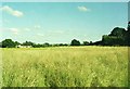
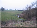
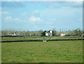
3 photos from this area
Area Information
Key information about the BA14 9HH including its size, population, and administrative classification.
- Area Type
- Postcode
- Area Size
- 36.7 hectares
- Population
- 2456
- Population Density
- 142 people/km²
House Prices in BA14 9HH
49
Properties
£121,140
Average Sold Price
£39,000
Lowest Price
£198,000
Highest Price
Showing 49 properties
| Address | Type | Beds | Baths | Last Sale Price | Last Sale Date | |
|---|---|---|---|---|---|---|
| 6 Lambrok Close, Trowbridge, BA14 9HH | Terraced | 3 | 1 | £190,000 | Dec 2018 | |
| 47 Lambrok Close, Trowbridge, BA14 9HH | Semi-detached | 3 | 1 | £198,000 | Mar 2018 | |
| 24 Lambrok Close, Trowbridge, BA14 9HH | Terraced | 3 | 1 | £166,500 | Dec 2017 | |
| 22 Lambrok Close, Trowbridge, BA14 9HH | Terraced | 3 | 1 | £141,000 | Mar 2017 | |
| 10 Lambrok Close, Trowbridge, BA14 9HH | Terraced | 3 | - | £163,500 | Jul 2016 | |
| 28 Lambrok Close, Trowbridge, BA14 9HH | house | - | - | £134,950 | Dec 2015 | |
| 16 Lambrok Close, Trowbridge, BA14 9HH | house | - | - | £107,000 | Jun 2010 | |
| 33 Lambrok Close, Trowbridge, BA14 9HH | house | 3 | 1 | £106,500 | May 2009 | |
| 45 Lambrok Close, Trowbridge, BA14 9HH | house | - | - | £164,995 | Jun 2008 | |
| 3 Lambrok Close, Trowbridge, BA14 9HH | Semi-detached | - | - | £158,500 | Nov 2007 |
Page 1 of 5
Energy Efficiency in BA14 9HH
Amenities
Schools
| Rank | School | Type | Entry gender | Ages |
|---|
Explore more schools in this area
Go to Schools tabDemographics
Household Size
Two person
most common
Accommodation Type
Houses
most common
Tenure
80
majority
Ethnic Group
White
most common
Religion
N/A
most common
Household Composition
N/A
most common
Age
47
median
Adults (30-64 years)
most common
Household Deprivation
N/A
with no deprivation
NS-SEC
34
in Lower managerial occupations
Explore more demographic insights in this area
Go to Demographics tabPlanning
Planning Constraints
- Flood RiskPremium
- Ramsar Wetland SitesPremium
- Area of Outstanding Natural BeautyPremium
- Protected Nature ReservePremium
- Protected WoodlandPremium