Area Overview for BA14 8TY
Photos of BA14 8TY
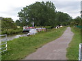


![Balls Bridge [No 168] from the north-east in BA14 8TY](https://images.propbar.co.uk/images/geograph/44/75/4475817_120.jpg)
67 photos from this area
Area Information
Key information about the BA14 8TY including its size, population, and administrative classification.
- Area Type
- Postcode
- Area Size
- 2891 m²
- Population
- 2853
- Population Density
- 1333 people/km²
House Prices in BA14 8TY
8
Properties
£256,611
Average Sold Price
£227,500
Lowest Price
£309,000
Highest Price
Showing 8 properties
| Address | Type | Beds | Baths | Last Sale Price | Last Sale Date | |
|---|---|---|---|---|---|---|
| 1 Bell Heather Close, Staverton, BA14 8TY | Detached | 3 | - | £309,000 | Aug 2022 | |
| 4 Bell Heather Close, Staverton, BA14 8TY | Detached | 3 | 2 | £227,500 | May 2017 | |
| 7 Bell Heather Close, Staverton, BA14 8TY | house | 4 | 2 | £239,950 | Jul 2015 | |
| 6 Bell Heather Close, Staverton, BA14 8TY | Detached | - | - | £249,995 | Dec 2005 | |
| 2 Bell Heather Close, Staverton, BA14 8TY | Flat | 2 | 1 | - | - | |
| 8 Bell Heather Close, Staverton, BA14 8TY | house | - | - | - | - | |
| 5 Bell Heather Close, Staverton, BA14 8TY | Flat | - | - | - | - | |
| 3 Bell Heather Close, Staverton, BA14 8TY | Detached | - | - | - | - |
Energy Efficiency in BA14 8TY
Amenities
Schools
| Rank | School | Type | Entry gender | Ages |
|---|
Explore more schools in this area
Go to Schools tabDemographics
Household Size
Family (3-5 people)
most common
Accommodation Type
Houses
most common
Tenure
63
majority
Ethnic Group
White
most common
Religion
N/A
most common
Household Composition
N/A
most common
Age
47
median
Adults (30-64 years)
most common
Household Deprivation
N/A
with no deprivation
NS-SEC
37
in Lower managerial occupations
Explore more demographic insights in this area
Go to Demographics tabPlanning
Planning Constraints
- Flood RiskPremium
- Ramsar Wetland SitesPremium
- Area of Outstanding Natural BeautyPremium
- Protected Nature ReservePremium
- Protected WoodlandPremium