Area Overview for BA14 7QY
Photos of BA14 7QY
Area Information
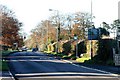
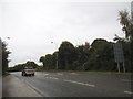
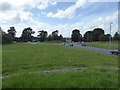
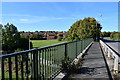
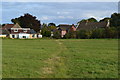
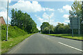
BA14 7QY represents a specific residential cluster within the wider civil parish of Hilperton, located in South West England. This small area covers just 1.8 hectares and supports a population of 1,913 residents. Living in this postcode area means residing in a compact, close-knit setting where daily life is defined by proximity to the historic fabric of Hilperton village. The location sits approximately 1½ miles north-north-east of Trowbridge, near the Kennet and Avon Canal and the Somerset and Weymouth railway line. The environment reflects a history of weaving and farming, with notable landmarks including the mid-18th century limestone Blind House and the Grade II* listed Hilperton House. While the area is small by urban standards, it retains character influenced by its heritage as a weaving village that once supported 12 households in the Domesday Book of 1086. Current life here revolves around the local amenities of Paxcroft and the nearby village centre, offering a settled rhythm for those seeking a residence near established transport links and established community grounds rather than a fast-paced urban environment.
- Area Type
- Postcode
- Area Size
- 1.8 hectares
- Population
- Not available
- Population Density
- Not available
Homes in BA14 7QY are characterised by a strong owner-occupied market. The data indicates that 83% of properties are owned outright or with a mortgage, suggesting that the area is primarily designed for buyers rather than private landlords. You will find a concentration of Houses, which matches the 1913 population distributed across the 1.8 hectares of this residential cluster. This high level of ownership typically means that the housing stock consists of established stock rather than newly built developments or purpose-built rental schemes. For those looking at properties here, the market reflects a preference for traditional house ownership over shared ownership or renting. The specific nature of the building stock revolves around the built structures within the Hilperton parish boundaries, serving the needs of local families who have roots in the parish. The 83% ownership rate is a clear indicator that households in this postcode have the financial capacity and desire to secure their own homes. Consequently, buyers entering this market are joining a community of owners who share an interest in maintaining the character of the Houses that define the local landscape.
House Prices in BA14 7QY
Showing 14 properties
| Address | Type | Beds | Baths | Last Sale Price | Last Sale Date | |
|---|---|---|---|---|---|---|
| Cockhatch, 124A Ashton Road, Hilperton, BA14 7QY | Detached | 4 | 2 | £670,000 | Sep 2019 | |
| The Grange, Ashton Road, Hilperton, BA14 7QY | Detached | 4 | 2 | £1,400,000 | Nov 2017 | |
| 123 Ashton Road, Hilperton, BA14 7QY | Detached | 4 | - | £465,000 | Dec 2015 | |
| 118 Ashton Road, Hilperton, BA14 7QY | Detached | 4 | 2 | £400,000 | Jan 2008 | |
| 120 Ashton Road, Hilperton, BA14 7QY | Detached | - | - | £360,000 | Feb 2004 | |
| Grange Cottage, 125 Ashton Road, Hilperton, BA14 7QY | house | 4 | 2 | - | - | |
| Ashton Lodge, 125C Ashton Road, Hilperton, BA14 7QY | Retail | 5 | 2 | - | - | |
| 122 Ashton Road, Hilperton, BA14 7QY | Detached | 3 | 2 | - | - | |
| Land Rear Of 3, Ashton Rise, Hilperton, BA14 7QY | Terraced | - | - | - | - | |
| Annexe Rear Of, 121 Ashton Road, Hilperton, BA14 7QY | Detached | - | - | - | - |
Energy Efficiency in BA14 7QY
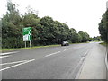
Living in BA14 7QY places you within practical reach of several retail and transport hubs. You can shop locally at Budgens Paxcroft or visit The Radstock Co-operative Society Co, both of which are listed as notable amenities within the area. Residents also have access to Tesco Trowbridge, offering a full range of grocery options further from the immediate postcode. For those who prefer supermarket shopping without the full commercial centre, these local outlets provide convenient daily supplies without requiring a long journey. Transport connectivity is achieved through five noted rail connections, with Trowbridge Railway Station, Bradford, and Melksham Railway Station serving the wider network. Being near these stations means residents can access broader travel networks while staying within the 1.8-hectare residential boundary. The mix of local co-ops, supermarkets, and rail access creates a lifestyle that balances village convenience with wider regional mobility. You can maintain a routine that involves walking to Budgens for essentials or taking a train from nearby Trowbridge for further travel.
Amenities
Schools
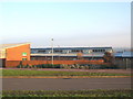
Educational provision for families living in BA14 7QY is served by The Mead Community Primary School. This institution offers primary education and holds a Good Ofsted rating, providing a solid foundation for children's early learning within a short distance of the residential cluster. The school is listed as the nearest educational facility, ensuring that local children have access to a state-regulated, high-performing institution without needing to travel far outside the immediate parish. The presence of a school with a Good rating suggests a commitment to educational standards in the Hilperton area. For parents reviewing options, this primary school represents the main on-the-apiary educational resource available to residents of this postcode and its immediate vicinity. The concentration of educational data points to a single key provider meeting the primary needs of the community's children.
| Rank | School | Type | Entry gender | Ages |
|---|
Explore more schools in this area
Go to Schools tabDemographics
The community in BA14 7QY is defined by a mature demographic profile with a median age of 47 years. Residents are predominantly adults aged between 30 and 64 years, indicating a stable population likely comprising families and long-term professionals rather than transient students or young workers. Home ownership stands at 83%, which signals a neighbourhood where most residents have purchased their properties and are invested in the area's long-term stability. The accommodation type is exclusively Houses, confirming that the built environment consists of detached or semi-detached dwellings rather than flats or apartments. The predominant ethnic group reported is White, which aligns with the broader demographic trends of Wiltshire and the South West of England. With a population density of 105,647 people per square kilometre recorded for this specific data point, the area demonstrates significant residential concentration according to the provided metrics. These figures describe a settled community where the majority of households own their freehold property and live in house-based accommodations.
Household Size
Accommodation Type
Tenure
Ethnic Group
Religion
Household Composition
Age
Household Deprivation
NS-SEC
Explore more demographic insights in this area
Go to Demographics tabPlanning
Planning Constraints
- Flood RiskPremium
- Ramsar Wetland SitesPremium
- Area of Outstanding Natural BeautyPremium
- Protected Nature ReservePremium
- Protected WoodlandPremium