Area Overview for BA14 7PL
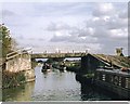
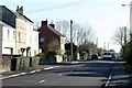
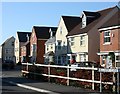
Photos of BA14 7PL
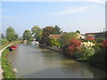
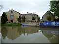
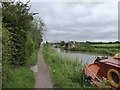
![Hilperton Road Bridge [No 166], from the east in BA14 7PL](https://images.propbar.co.uk/images/geograph/44/75/4475789_120.jpg)
37 photos from this area
Area Information
Key information about the BA14 7PL including its size, population, and administrative classification.
- Area Type
- Postcode
- Area Size
- 7.3 hectares
- Population
- 2853
- Population Density
- 1333 people/km²
House Prices in BA14 7PL
32
Properties
£274,044
Average Sold Price
£58,000
Lowest Price
£477,250
Highest Price
Showing 32 properties
| Address | Type | Beds | Baths | Last Sale Price | Last Sale Date | |
|---|---|---|---|---|---|---|
| 312 Marsh Road, Hilperton Marsh, BA14 7PL | Detached | 5 | 3 | £440,000 | Apr 2024 | |
| 305 Marsh Road, Hilperton Marsh, BA14 7PL | Bungalow | 3 | 2 | £400,000 | Jul 2023 | |
| 309 Marsh Road, Hilperton Marsh, BA14 7PL | house | 4 | 2 | £477,250 | Feb 2022 | |
| 318 Marsh Road, Hilperton Marsh, BA14 7PL | house | - | - | £435,000 | Feb 2022 | |
| 320 Marsh Road, Hilperton Marsh, BA14 7PL | Terraced | 2 | 1 | £197,500 | Dec 2019 | |
| 322 Marsh Road, Hilperton Marsh, BA14 7PL | Detached | 3 | 2 | £243,000 | Jul 2019 | |
| 310 Marsh Road, Hilperton Marsh, BA14 7PL | Detached | - | - | £250,000 | May 2008 | |
| 298 Marsh Road, Hilperton Marsh, BA14 7PL | Detached | - | - | £353,000 | Aug 2007 | |
| 307 Marsh Road, Hilperton Marsh, BA14 7PL | Detached | - | - | £280,000 | Aug 2007 | |
| 306 Marsh Road, Hilperton Marsh, BA14 7PL | Detached | - | - | £266,000 | Apr 2007 |
Page 1 of 4
Energy Efficiency in BA14 7PL
Amenities
Schools
| Rank | School | Type | Entry gender | Ages |
|---|
Explore more schools in this area
Go to Schools tabDemographics
Household Size
Family (3-5 people)
most common
Accommodation Type
Houses
most common
Tenure
63
majority
Ethnic Group
White
most common
Religion
N/A
most common
Household Composition
N/A
most common
Age
47
median
Adults (30-64 years)
most common
Household Deprivation
N/A
with no deprivation
NS-SEC
37
in Lower managerial occupations
Explore more demographic insights in this area
Go to Demographics tabPlanning
Planning Constraints
- Flood RiskPremium
- Ramsar Wetland SitesPremium
- Area of Outstanding Natural BeautyPremium
- Protected Nature ReservePremium
- Protected WoodlandPremium