Area Overview for BA14 7NU
Photos of BA14 7NU
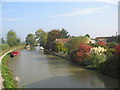
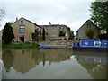
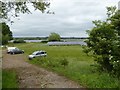
![Hilperton Road Bridge [No 166], from the east in BA14 7NU](https://images.propbar.co.uk/images/geograph/44/75/4475789_120.jpg)

37 photos from this area
Area Information
Key information about the BA14 7NU including its size, population, and administrative classification.
- Area Type
- Postcode
- Area Size
- 6960 m²
- Population
- 1519
- Population Density
- 2778 people/km²
House Prices in BA14 7NU
15
Properties
£166,002
Average Sold Price
£49,950
Lowest Price
£425,000
Highest Price
Showing 15 properties
| Address | Type | Beds | Baths | Last Sale Price | Last Sale Date | |
|---|---|---|---|---|---|---|
| 174 Wyke Road, Hilperton, BA14 7NU | Terraced | 2 | 1 | £237,000 | Dec 2023 | |
| Anasden House, 182 Wyke Road, Hilperton, BA14 7NU | Detached | 4 | 2 | £425,000 | May 2022 | |
| 176 Wyke Road, Hilperton, BA14 7NU | Terraced | 2 | 1 | £162,318 | Nov 2016 | |
| 186 Wyke Road, Hilperton, BA14 7NU | house | - | - | £198,000 | Sep 2010 | |
| 172 Wyke Road, Hilperton, BA14 7NU | Terraced | 2 | 1 | £82,000 | May 2004 | |
| 170 Wyke Road, Hilperton, BA14 7NU | Terraced | - | - | £66,750 | Nov 2001 | |
| 188 Wyke Road, Hilperton, BA14 7NU | house | - | - | £107,000 | Jul 2000 | |
| 178 Wyke Road, Hilperton, BA14 7NU | Terraced | - | - | £49,950 | May 1998 | |
| 166A Wyke Road, Hilperton, BA14 7NU | Detached | 3 | 2 | - | - | |
| 168A Wyke Road, Hilperton, BA14 7NU | Detached | 3 | - | - | - |
Page 1 of 2
Energy Efficiency in BA14 7NU
Amenities
Schools
| Rank | School | Type | Entry gender | Ages |
|---|
Explore more schools in this area
Go to Schools tabDemographics
Household Size
Two person
most common
Accommodation Type
Houses
most common
Tenure
79
majority
Ethnic Group
White
most common
Religion
N/A
most common
Household Composition
N/A
most common
Age
47
median
Adults (30-64 years)
most common
Household Deprivation
N/A
with no deprivation
NS-SEC
31
in Lower managerial occupations
Explore more demographic insights in this area
Go to Demographics tabPlanning
Planning Constraints
- Flood RiskPremium
- Ramsar Wetland SitesPremium
- Area of Outstanding Natural BeautyPremium
- Protected Nature ReservePremium
- Protected WoodlandPremium