Area Overview for BA14 6PY
Photos of BA14 6PY
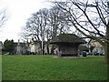
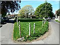
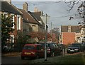
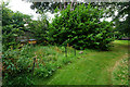
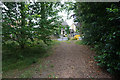
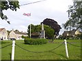
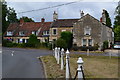
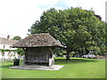
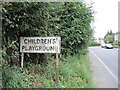
65 photos from this area
Area Information
Key information about the BA14 6PY including its size, population, and administrative classification.
- Area Type
- Postcode
- Area Size
- 1.3 hectares
- Population
- 1351
- Population Density
- 188 people/km²
House Prices in BA14 6PY
19
Properties
£277,375
Average Sold Price
£89,000
Lowest Price
£765,000
Highest Price
Showing 19 properties
| Address | Type | Beds | Baths | Last Sale Price | Last Sale Date | |
|---|---|---|---|---|---|---|
| Ham Tree House, 65 Ham Close, Holt, BA14 6PY | Detached | 4 | 3 | £765,000 | Aug 2024 | |
| 58 Ham Green, Holt, BA14 6PY | house | 2 | - | £275,500 | Jun 2022 | |
| 64 Ham Green, Holt, BA14 6PY | house | - | - | £250,000 | Apr 2022 | |
| 59 Ham Green, Holt, BA14 6PY | Cottage | 2 | 1 | £232,000 | Aug 2021 | |
| 60 Ham Green, Holt, BA14 6PY | house | 2 | 1 | £228,500 | Mar 2021 | |
| 71 Ham Green, Holt, BA14 6PY | Semi-detached | 4 | - | £415,000 | Oct 2020 | |
| 57 Ham Green, Holt, BA14 6PY | house | 2 | - | £172,000 | Jun 2019 | |
| 63 Ham Green, Holt, BA14 6PY | Semi-detached | 2 | 1 | £310,000 | Feb 2019 | |
| 61 Ham Green, Holt, BA14 6PY | house | 2 | - | £212,000 | May 2018 | |
| 62A Ham Green, Holt, BA14 6PY | Bungalow | 2 | 1 | £300,000 | Nov 2017 |
Page 1 of 2
Energy Efficiency in BA14 6PY
Amenities
Schools
| Rank | School | Type | Entry gender | Ages |
|---|
Explore more schools in this area
Go to Schools tabDemographics
Household Size
Two person
most common
Accommodation Type
Houses
most common
Tenure
70
majority
Ethnic Group
White
most common
Religion
N/A
most common
Household Composition
N/A
most common
Age
47
median
Adults (30-64 years)
most common
Household Deprivation
N/A
with no deprivation
NS-SEC
41
in Lower managerial occupations
Explore more demographic insights in this area
Go to Demographics tabPlanning
Planning Constraints
- Flood RiskPremium
- Ramsar Wetland SitesPremium
- Area of Outstanding Natural BeautyPremium
- Protected Nature ReservePremium
- Protected WoodlandPremium