Area Overview for BA14 6JX
Photos of BA14 6JX
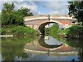
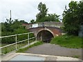
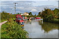
![Semington Bridge [No 160], Kennet & Avon Canal in BA14 6JX](https://images.propbar.co.uk/images/geograph/44/75/4475464_120.jpg)
19 photos from this area
Area Information
Key information about the BA14 6JX including its size, population, and administrative classification.
- Area Type
- Postcode
- Area Size
- 62.4 hectares
- Population
- 1837
- Population Density
- 364 people/km²
House Prices in BA14 6JX
3
Properties
£770,000
Average Sold Price
£590,000
Lowest Price
£950,000
Highest Price
Showing 3 properties
| Address | Type | Beds | Baths | Last Sale Price | Last Sale Date | |
|---|---|---|---|---|---|---|
| Outmarsh Farm, Outmarsh, Semington, BA14 6JX | house | - | - | £950,000 | Feb 2021 | |
| The Halt, 561 Outmarsh, Semington, BA14 6JX | Cottage | 4 | 3 | £590,000 | Oct 2017 | |
| Wiltshire Air Ambulance Station, Outmarsh, Semington, BA14 6JX | office_workshop | - | - | - | - |
Energy Efficiency in BA14 6JX
Amenities
Schools
| Rank | School | Type | Entry gender | Ages |
|---|
Explore more schools in this area
Go to Schools tabDemographics
Household Size
Two person
most common
Accommodation Type
Houses
most common
Tenure
63
majority
Ethnic Group
White
most common
Religion
N/A
most common
Household Composition
N/A
most common
Age
47
median
Adults (30-64 years)
most common
Household Deprivation
N/A
with no deprivation
NS-SEC
26
in Lower managerial occupations
Explore more demographic insights in this area
Go to Demographics tabPlanning
Planning Constraints
- Flood RiskPremium
- Ramsar Wetland SitesPremium
- Area of Outstanding Natural BeautyPremium
- Protected Nature ReservePremium
- Protected WoodlandPremium