Area Overview for BA14 6AU
Photos of BA14 6AU
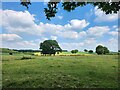
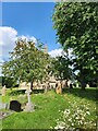
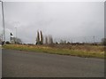
7 photos from this area
Area Information
Key information about the BA14 6AU including its size, population, and administrative classification.
- Area Type
- Postcode
- Area Size
- 4.6 hectares
- Population
- 1594
- Population Density
- 152 people/km²
House Prices in BA14 6AU
28
Properties
£308,889
Average Sold Price
£102,500
Lowest Price
£560,000
Highest Price
Showing 28 properties
| Address | Type | Beds | Baths | Last Sale Price | Last Sale Date | |
|---|---|---|---|---|---|---|
| 6 Orchard Close, West Ashton, BA14 6AU | Bungalow | 2 | 2 | £375,000 | Nov 2025 | |
| 7 Orchard Close, West Ashton, BA14 6AU | Bungalow | 5 | 3 | £352,500 | Oct 2021 | |
| 20 Orchard Close, West Ashton, BA14 6AU | Detached | 5 | - | £560,000 | Sep 2021 | |
| 13 Orchard Close, West Ashton, BA14 6AU | Detached | 5 | 2 | £410,000 | Feb 2021 | |
| 18 Orchard Close, West Ashton, BA14 6AU | Detached | 5 | 3 | £435,000 | Aug 2018 | |
| 19 Orchard Close, West Ashton, BA14 6AU | Detached | 5 | - | £375,000 | Dec 2015 | |
| 9 Orchard Close, West Ashton, BA14 6AU | Bungalow | 3 | - | £275,000 | Oct 2015 | |
| Roosters, 14 Orchard Close, West Ashton, BA14 6AU | Detached | 4 | - | £250,000 | Dec 2013 | |
| 25 Orchard Close, West Ashton, BA14 6AU | Detached | 5 | - | £282,500 | Sep 2013 | |
| 3 Orchard Close, West Ashton, BA14 6AU | Detached | - | - | £242,000 | Apr 2004 |
Page 1 of 3
Energy Efficiency in BA14 6AU
Amenities
Schools
| Rank | School | Type | Entry gender | Ages |
|---|
Explore more schools in this area
Go to Schools tabDemographics
Household Size
Family (3-5 people)
most common
Accommodation Type
Houses
most common
Tenure
72
majority
Ethnic Group
White
most common
Religion
N/A
most common
Household Composition
N/A
most common
Age
47
median
Adults (30-64 years)
most common
Household Deprivation
N/A
with no deprivation
NS-SEC
40
in Lower managerial occupations
Explore more demographic insights in this area
Go to Demographics tabPlanning
Planning Constraints
- Flood RiskPremium
- Ramsar Wetland SitesPremium
- Area of Outstanding Natural BeautyPremium
- Protected Nature ReservePremium
- Protected WoodlandPremium